Access and import authoritative LINZ (Land Information New Zealand) vector datasets directly into your DWG through the LINZ WFS (Web Feature Service). Spatial Manager connects to the WFS endpoint and lists available features. It reprojects on the fly to the active drawing coordinate reference system. There’s no need to download and unzip intermediate files: features are streamed directly from the live WFS service and inserted as standard CAD entities you can snap to, analyze or export again. Keep your DWG up to date with the latest LINZ data.
Available for AutoCAD, BricsCAD, ZWCAD, GstarCAD and Desktop.
Follow these simple steps to connect to LINZ WFS services:
1. Register and create a free account
- To connect to LINZ services, a free account is required.
- Open LINZ account register URL and follow the registration steps.
- This will create a Koordinates ID account, valid for accessing LINZ datasets.
2. Login with the created user
- Open LINZ data portal
- In the top-right corner, click “Log in” and log in with the created user.
3. Explore the catalog or search vector datasets
- Explore the existing datasets and use the search box to find vector datasets.
- Suitable layers must appear as Point, Line or Polygon types.
- Next to each dataset, the update date is shown.
- Click the desired dataset.
4. Add to the map and preview
- On the dataset page, click the “Map +” button.
- This will show the map viewer with the dataset loaded.
5. Copy WFS service URL
- Go to the “Services and APIs” tab.
- Find the WFS section and copy the URL of the WFS service with the “Layer WFS Capabilities” label.
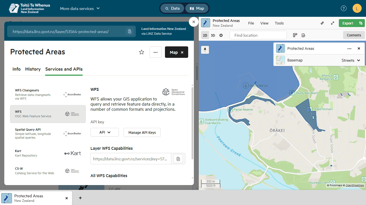
LINZ WFS service
6. Define a User Data Source
- Run the SPM command to open the main palette (for Spatial Manager Desktop, go to the docked panel).
- Right-click the “User data sources” node and then select the “Create user data source” option.
- In the provider list, select “WFS / OGC API - Features” and click “Next”.
7. Configure the WFS service connection
- Paste the copied WFS URL in the “URL” field.
- For some services, depending on the coordinate reference systems used, the “Invert coordinates order” option may be required; enable it if needed.
- Finish the assistant and save the User Data Source with a recognizable name.
8. Import vector layer
- Expand the created User Data Source node, select the desired layer, and click an “Import” option in the context menu (right-click).
- If you are importing into an existing drawing with data, it is recommended to check the “Import only Features in the current view” option to speed up the process and avoid a heavy drawing.
- The imported geometries include attached data that can be reviewed in the main palette (SPM command) or in a grid format (SPMDATATABLEGRID command).
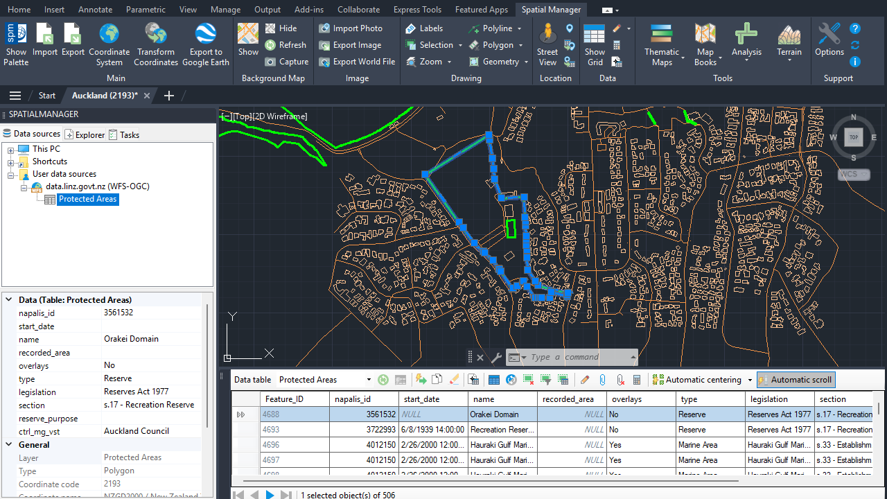
LINZ WFS data
Spatial Manager products support all WFS versions (1.0, 1.1, and 2.0) and the new OGC API - Features services (previously known as WFS 3.0). WFS services can be used not only for LINZ data but also for other public or private data sources around the world.
Note: Some features are available only in the Standard or Professional editions.



