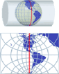
Projecting Maps on the fly
Spatial Manager Desktop™ considers the coordinate systems of the Layers in a Map to get a real view of their Features which will be projected according to the coordinate system of the Map When working with an application that includes the... more


