Following several previous posts about how to configure and apply diverse parameters for Google Maps as dynamic Background Maps in ‘Spatial Manager’ (AutoCAD, BricsCAD, ZWCAD or Desktop), you can learn here how to add Real-Time Traffic and Transit (public transport tracing) information to these maps
In the post “Google Maps in your CAD drawings? Of course” published in this Blog some months ago, you can review how to configure Google Maps in the Background Maps system of ‘Spatial Manager’ and the use of basic parameters
Also, in a later post “More about dynamic Google Maps in your drawings or Maps” you can find out how to use a set of advanced map parameters in order to define the map type or the language of the texts and toponyms in the maps if available
The complementary parameters “Traffic” and “Transit” will now allow you to add traffic status and public transport lines to any of the Google Maps. Take a look at the application of these parameters in the following examples:
URL: https://{mt,mt0,mt1,mt2,mt3}.google.com/vt/lyrs=m,traffic&x={x}&y={y}&z={level}
Result: Google Maps “Standard” + Traffic status
Map (Click in the image to enlarge):
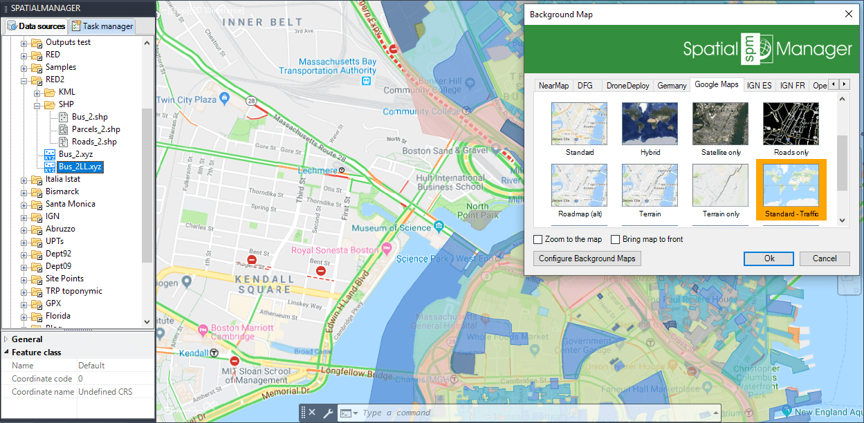
Google Maps Standard + Traffic
URL: https://{mt,mt0,mt1,mt2,mt3}.google.com/vt/lyrs=y,traffic&x={x}&y={y}&z={level}
Result: Google Maps “Satellite Hybrid” + Traffic status
Map (Click in the image to enlarge):
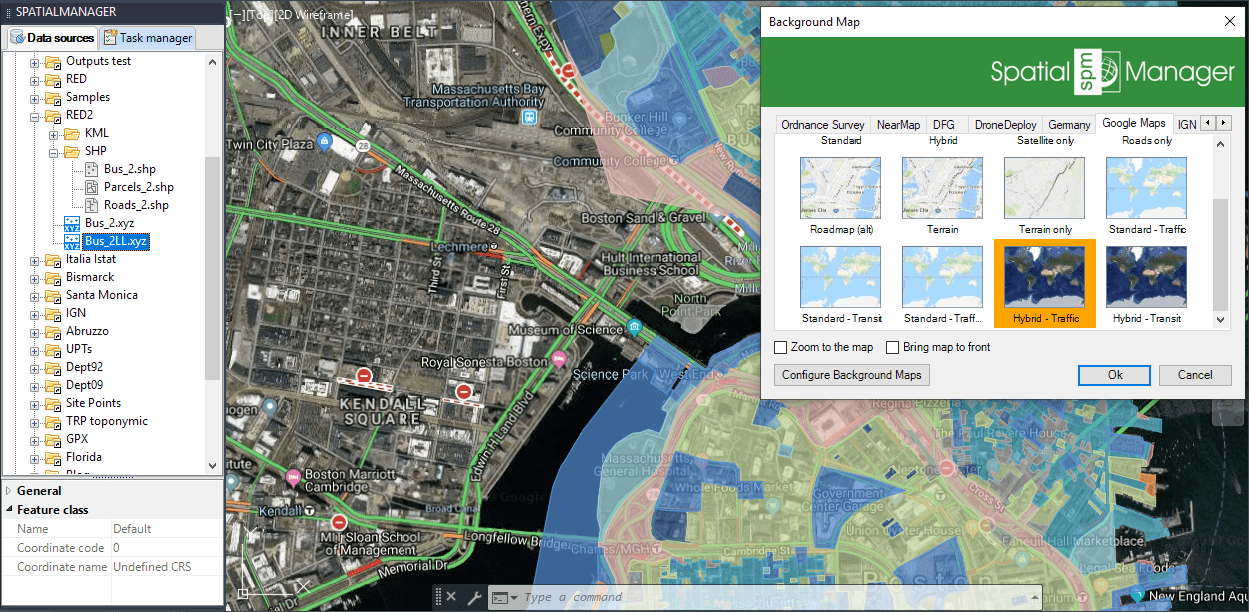
Google Maps Satellite Hybrid + Traffic
URL: https://{mt,mt0,mt1,mt2,mt3}.google.com/vt/lyrs=h,transit&x={x}&y={y}&z={level}&hl=fr
Result: Google Maps “Roads only” + Public transport lines (Transit). French texts, if available
Map (Click in the image to enlarge):
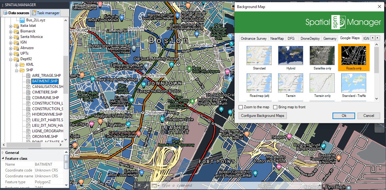
Google Maps Roads only + Transit (Public transport)
You can even combine both parameters in the map URL. Thus, for example, the map above could show Traffic and Transit using the two parameters together:
https://{mt,mt0,mt1,mt2,mt3}.google.com/vt/lyrs=h,traffic,transit&x={x}&y={y}&z={level}&hl=fr
In addition, the “Transit” information can be configured as an isolated layer, without the need to combine it with any other layer, if you want to have Public Transport lines only:
https://{mt,mt0,mt1,mt2,mt3}.google.com/vt/lyrs=transit&x={x}&y={y}&z={level}
And, although Traffic information cannot be presented separately, you can combine it with the Transit lines:
https://{mt,mt0,mt1,mt2,mt3}.google.com/vt/lyrs=transit,traffic&x={x}&y={y}&z={level}
Try to combine parameters by yourself in order to get the custom maps that you are interested in


