Spatial Manager Blog : Labels (page 2)

Labeling objects while importing: New options...
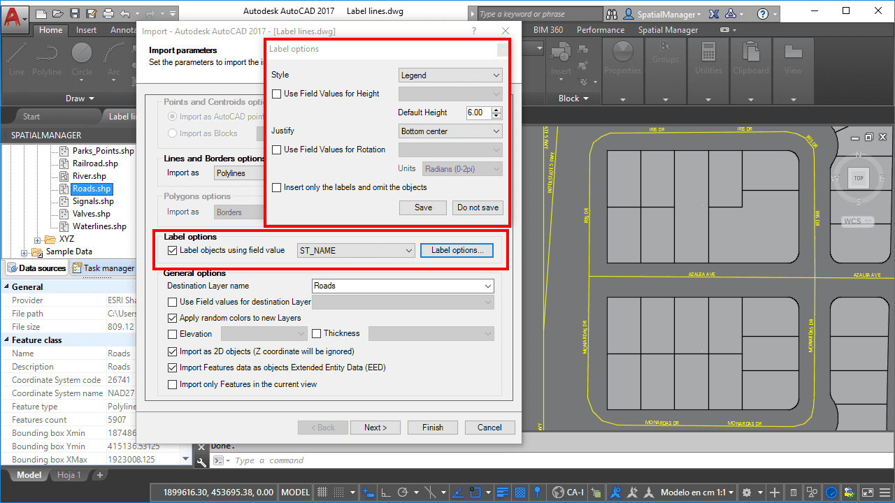
Inside one of the main ‘Spatial Manager’ functionalities, the ability to import features from tens of cartographic and GIS file formats and databases into your drawings (AutoCAD, BricsCAD or ZWCAD), you can find the option to label the objects as... more

Lightning Speed Areas Labeling
The Exporting / Importing tools built in ‘Spatial Manager’ provide you with a wide variety of options and parameters that will allow you to take advantage of them in order to perform some tedious tasks at lightning speed in AutoCAD,... more

Tricks to optimize labeling while importing
The generation of labels or tags when importing spatial objects into AutoCAD, BricsCAD or ZWCAD using ‘Spatial Manager’, includes multiple options that allow the user to customize the marking of the objects based on the values in the spatial... more

Texts to Labels when Publishing to Google Earth
From of ‘Spatial Manager’ v.4 (AutoCAD / BricsCAD / ZWCAD), when a drawing is Published to Google Earth the text objects are exported as named points in order to display the tags automatically Related videos: more

Labeling Polylines too. ‘Smart’ labels and …
If you are working with ‘Spatial Manager’ v.3.3 or a later version, you can Label while importing linear elements (Polylines), just like you could with points elements (Points, Blocks, Polygon Centroids …) in previous versions of the application more

Labeling objects while importing
Text Labels help to complete the CAD or GIS drawings and maps and enrich the complementary information contained therein, as they not only allow better understanding but also make it easier to locate the objects. Spatial Manager™ (AutoCAD and BricsCAD) now includes the objects... more