‘Spatial Manager’ version 7.0.3 is compatible with the latest available CAD versions and Windows 11 (see below). In this version, released today, you will also find some interesting improvements. Download it (*) and enjoy from today the enhancements and new functions included in ‘Spatial Manager 7.0.3’
Import/export spatial or GIS data, and experience the advanced tools to manage spatial data, such as GIS analysis tools, Street View, Terrains and Contours, dynamic Background Maps, quick drawing Publishing in Google Earth, data structures and Data Grid, Queries and Spatial queries, Transform drawings CRS, Search for locations, layer thematics, automatic labeling, etc.
(*) Download ‘Spatial Manager’ v.7.0.3
List of compatible latest CAD versions:
- AutoCAD 2022.1, AutoCAD Map 2022.0.1, and many Autodesk 2022 software
- BricsCAD 22
- ZWCAD 2022 SP1
- GstarCAD 2022
Windows 11 compatible
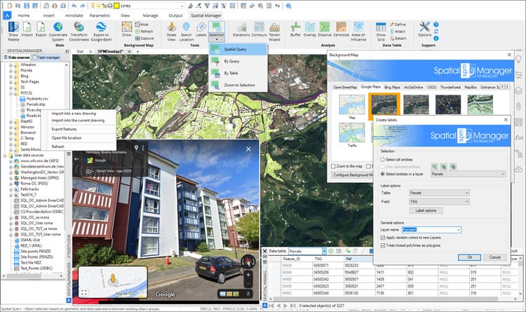
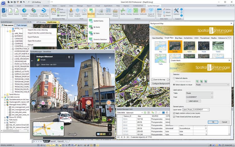
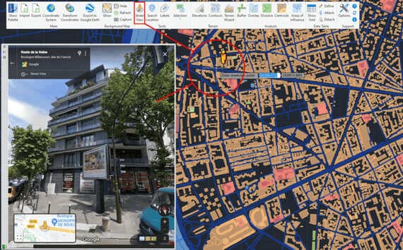
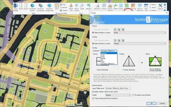
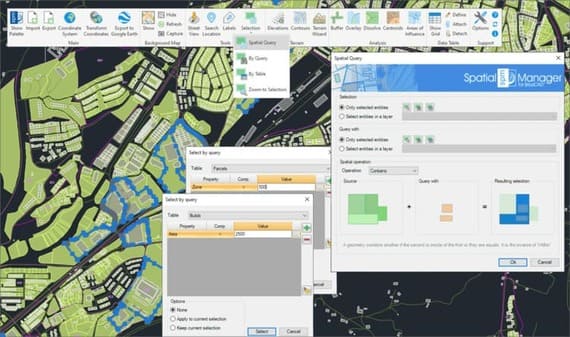
Some ‘Spatial Manager 7.0.3’ screenshots:
New features and improvements (The latest changes in versions 7.0.2 and 7.0.3 are in italics):
- Street View - New Palette for displaying (and navigate) dynamic Google Street View images on any drawing/map (see Related Blog Post)
- GIS analysis tools - Advanced geometric and data operations for creating new objects from analysis processes
- Buffer: Buffered polygons around point objects, linear objects or polygon boundaries
- Overlay: New objects based on geometric and data operations between existing object groups (Intersect, Union, Erase, Identity, Clip, Paste or Symmetric Difference)
- Dissolve: New polygons based on the grouping of other adjacent polygons with some common data (see Related Blog Post)
- Centroids: Polygon Centroids creation by adopting the polygons data, or Polygon creation based on found internal Centroids (see Related Blog Post)
- Areas of Influence: Polygons defined by the set of points closest to each point of a selection of points in the drawing (Voronoi diagrams)
- Spatial Query Selection - Advanced object selection system based on geometric and data operations between existing object groups (Intersect, Touches, Within, Contains, Disjoint, Overlaps or Crosses) (see Related Blog Post)
- Object Labeling - Texts based on objects data (see Related Blog Post)
- Other
- User-selected location and name for image files resulting from Background Map captures
- Transparent dynamic Background Map regeneration on view changes (Zooms, Pan, etc.) even if another command is running
- Option to label linear objects at a single point and not only by means of repeated labels along the length of the object
- GPX (GPS) data provider now also supports writing
- New provider for reading Esri ASCII Grid files
- Data related selection options (by Table and by Query) in the commands that allow selecting objects (Export, Publication to Google Earth, etc.)
- Simultaneous removal of several Fields in Data Table definitions
- Optional selection of the required Grid files for a Coordinate Transformation using Grids
- Updated main Esri projected coordinate systems (ArcGIS 12.8), EPSG tables (version 10.037) and many other local CRSs
- Revamped interface layout and icons design
- Authentication via HTTP headers for WFS servers and Background Maps has been added
- Define/modify the length of text Fields
- Object Selection by Query has been improved: The last Query processed is remembered independently for each order
- Source and target names are now shown in the import/export process execution windows, both in single and batch processes
- New option to add or not data to optional polygon Hatches in SPMIMPORT. In all other cases no data is added to the Hatches (SPMBUFFER, SPMOVERLAY, SPMDISSOLVE, SPMINFLUENCEAREAS)
- Now the SPMCLOSE command closes all application palettes (Main Palette, Data Grid, Steet View, etc.) and restores their default position and dimension values
- Now you can run the Export function on the command line (-SPMEXPORT), and use it in Scripts, Lisp routines, etc.
- …and more
Notes:
- Some application features may be found in the CAD versions only
- Some news applies to Standard and/or Professional editions only
Take a look at the application Changelog (7.0.1 + 7.0.2 + 7.0.3) in order to review the complete list of News, Improvements and Fixes in this version
