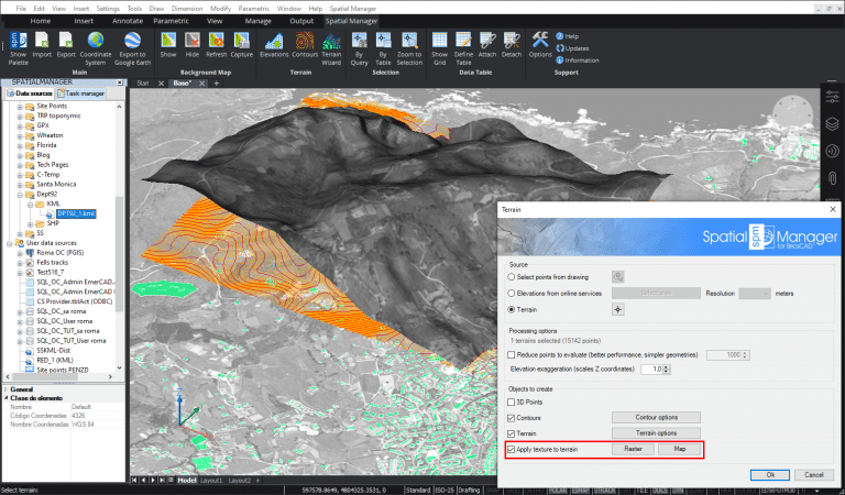
Release 6 of ‘Spatial Manager’ (CAD versions) featured a set of functions designed in order to create Terrains, Contours, 3D Points, etc. from 3D data in the drawing or from elevation servers. Although this version already included the ability to project any Background Map over the Terrains, the latest version released a few days ago adds the option to also project any raster image in the drawing
Related videos: AutoCAD / BricsCAD
In the above videos you can learn how to apply to a Terrain images from any selected Background Map (preset or user-defined) or from a raster image that is inserted in the drawing. In the sample you can also find out how to simultaneously achieve Contours, set the options available for this type of object and other options related to the terrain itself, 3D resolution, etc.
Please, take a look
Learn more about Terrains in the ‘Spatial Manager’ technical Wiki:
Notes:
- Terrains functionality can only be found in the Professional edition
- While you can create Terrains (as well as other related objects) in AutoCAD, BricsCAD and ZWCAD, the functionality to apply maps/raster images to Terrains is not available in ZWCAD


