Yandex provides image mapping services as an alternative to similar ones such as Google Maps, OpenStreetMap, etc. Yandex allows users access to tile map servers (XYZ/TMS) for the whole planet but with more diffusion and detail for Eastern European countries
Related videos: AutoCAD / BricsCAD / ZWCAD / Desktop
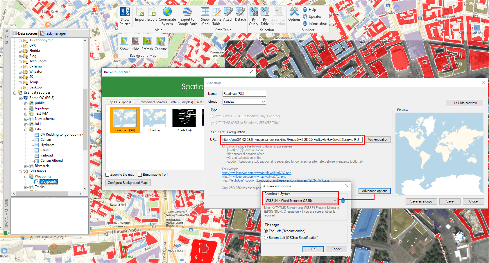
Yandex Maps configured as ‘Spatial Manager’ dynamic Background Maps
Although Yandex is a global services platform on the web, in this Blog post we will focus on the access and use of the Yandex Maps and their configuration and application in ‘Spatial Manager’ as user dynamic Background Maps
As mentioned above, this map server uses the XYZ/TMS specifications and protocols similar for example to Google Maps servers widely discussed in this Blog, although some differential nuances must be noted:
Next you can find some examples of URLs appropriate in order to access the Yandex maps:
Roadmap (toponyms):
https://vec{01,02,03,04}.maps.yandex.net/tiles?l=map&lang=ru-RU&v=2.26.0&x={x}&y={y}&z={level}
Roadmap (US English toponyms):
https://vec{01,02,03,04}.maps.yandex.net/tiles?l=map&lang=en-US&v=2.26.0&x={x}&y={y}&z={level}
Satellite:
https://sat{01,02,03,04}.maps.yandex.net/tiles?l=sat&&v=2.26.0&x={x}&y={y}&z={level}
Only Roads (that you can Bring to front above of your drawing/maps objects):
https://vec{01,02,03,04}.maps.yandex.net/tiles?l=skl&v=2.26.0&x={x}&y={y}&z={level}
Parameters detail:
- “https://vec” or “https://sat”: The map servers (read above)
- “{01,02,03,04}”: Sub-domains available on these servers (learn more on this Blog post)
- “l=“: Map layer
- “lang=” (optional): Language for the map Toponyms, according to the specifications of the standard two-characters ISO
The above videos will show you how to deal with Yandex Maps in ‘Spatial Manager’ (and a little trick to get Hybrid Maps – Satellite + Roads – in the application CAD versions)
Learn more about configuring user dynamics Background Maps in ‘Spatial Manager’:
- Spatial Manager for AutoCAD
- Spatial Manager for BricsCAD
- Spatial Manager for ZWCAD
- Spatial Manager Desktop
Note: In ‘Spatial Manager’ for CAD versions (AutoCAD, BricsCAD and ZWCAD), the Background Maps functionality can be found in the Standard and Professional editions only


