One of the functions most appreciated by ‘Spatial Manager’ users is the management of the Background Maps (‘BG Maps’) based on imagery downloaded in real time from map services or cartographic servers. The version 4 of this applications suite released on October 2017, significantly improves the potential of the ‘BG Maps’ technology
Related videos: Desktop / AutoCAD / BricsCAD
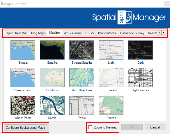
When the ‘BG Maps’ window opens, the user can now find more preset maps distributed in more groups inside in a bigger window (see the image below)
In addition, this window now includes the Button ‘Configure Background Maps’ and the option ‘Zoom to the map’. The first button will take you to the parameter windows of some preset ‘BG Maps’ or to the configuration of the ‘User BG Maps’. Previously, this was only accessible from the application settings (or options)
The new option ‘Zoom to the map’ is here in order to instruct the Application on how to zoom to the optimal ‘View’ when showing a ‘BG Map’ in your drawing or map, according to the criteria detailed in the corresponding article of any product Technical Documentation (links to for: Desktop / AutoCAD / BricsCAD)
Enhanced ‘User Background Maps’
The ‘BG Maps‘ technology in ‘Spatial Manager’ allows you not only to use the preset Maps, but also to configure your own ‘User BG Maps’ taking advantage of any accessible WMS, WMTS or XYZ/TMS Map service. New:
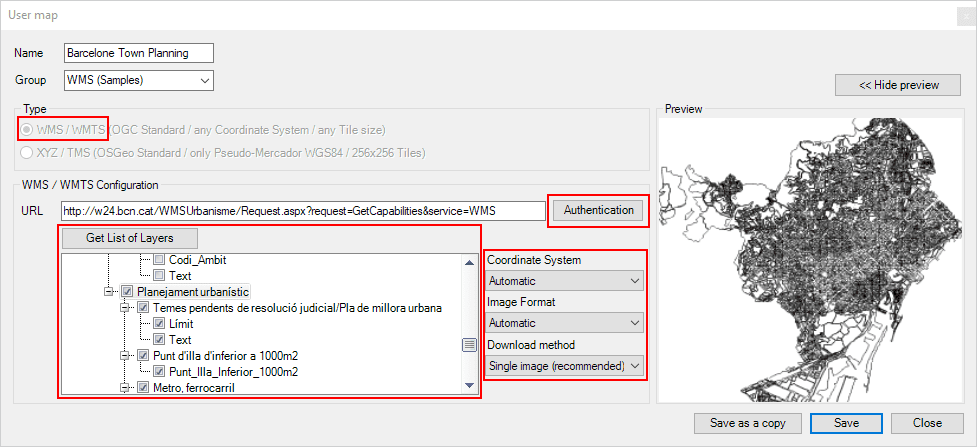
Configuring WMS ‘User Background Maps’
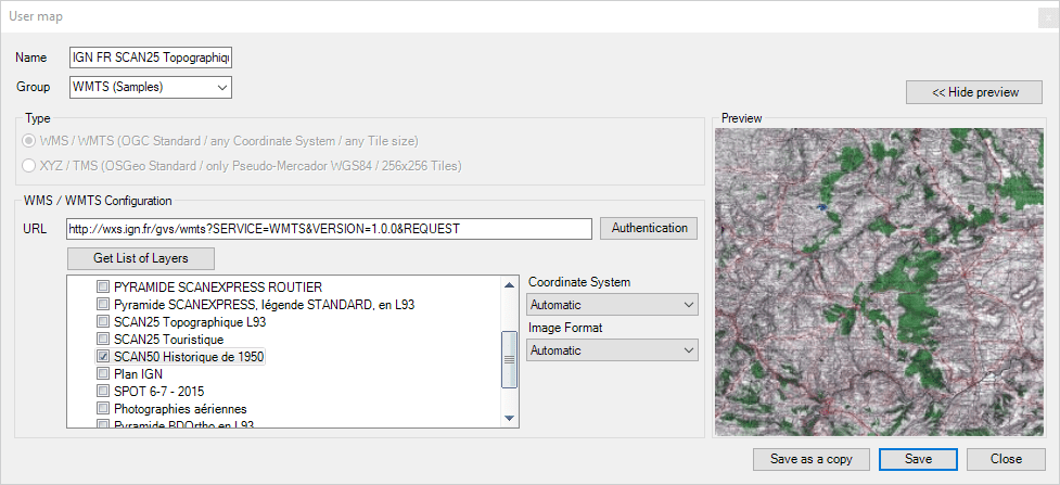
Similar window when configuring WMTS ‘User Background Maps’
Please, go to the Documentation if you want to learn more about the ‘User BG Maps’:
· Spatial Manager Desktop
· Spatial Manager for AutoCAD
· Spatial Manager for BricsCAD


