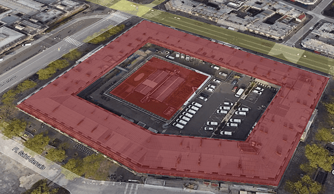
Usually in CAD, due to drafting processes, polygons are represented as closed polylines. This may be a problem when representing, visualizing or exporting to GIS formats (or even Google Earth)
In this post we will explain how to easily create polygons with holes, islands or multiple separate surfaces
Available for AutoCAD, BricsCAD, ZWCAD and GstarCAD
1. Show background map and search location
- On an empty drawing we enable a Background Map for use as base for drafting, execute SPMBGMAPSHOW and select any map
- Go to your project location or execute SPMSEARCHLOCATION to locate more quickly
2. Draw polylines of a building with holes and islands
- Draw the building limits (perimiter, inner holes and islands is if required)
3. Create hatches. For helping us in the process, hatches are used. Hatch is a entity type that is something similar to polygons
- Execute _HATCH command and click at the zones that are solid surfaces on the modeled object
4. Export to Google Earth
- Now you can publish to Google Earth executing SPMCREATEKML command (you could also export to most common GIS formats using SPMEXPORT command)
- View the result on Google Earth
Note: Some functionalities can be found in the Standard or Professional editions only


