A set of objects imported by applying its coordinate Z=0 leads to a “flat” map which allows us often to perform operations that are more “uncomfortable” when using 3D maps: 2D references, measurements of distances in the plane, etc.
Importing “2D” maps
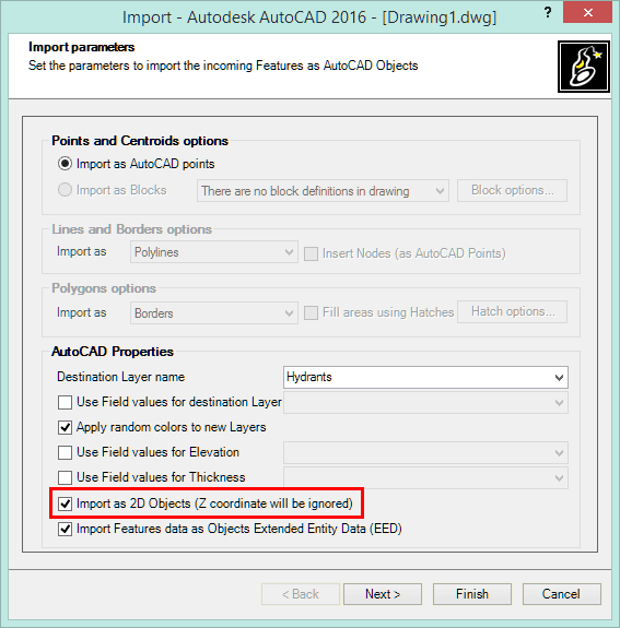
When importing objects into AutoCAD or BricsCAD drawings using Spatial Manager™, you will find an option to ignore their Z coordinates in the Importing parameters window (see image below and the Documentation AutoCAD/BricsCAD)
By using this option you can select the importation of Points, Polylines or Polygons including 3D data or 2D data only, causing their transfer to the XY plane. Even in the case of 3D polylines whose vertices may be located at different Z coordinates, the importing process will result in a “projection” of the polyline to the XY plane
There is a quite common situation in which it is handy to obtain a 2D map from 3D cartography and simultaneously label the Z coordinates of the objects: see “Point coordinates also as data fields”