‘Spatial Manager’ Background Maps technology allows AutoCAD or BricsCAD users to show in the drawings, dynamic images of Maps coming from XYZ/TMS, WMS or WMTS services. When printing or exporting to a PDF file a drawing including a Background Map, the layer of the Map can be turned on or off in the PDF viewer in order to show it or hide it
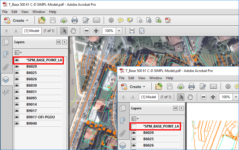
Background Map PDF Layer On/Off
Related videos: AutoCAD / BricsCAD
When printing or exporting from AutoCAD be sure to activate the “Include layer information” option:
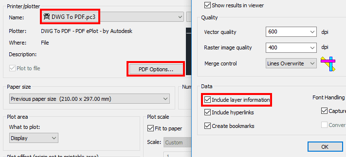
Print to PDF from AutoCAD
If you are printing or exporting from BricsCAD select “Use all layers…” in the “Layers support” option:
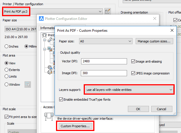
Print to PDF from BricsCAD
Learn more about the ‘Spatial Manager’ Background Maps in this Blog or in the Technical Documentation of ‘Spatial Manager for AutoCAD’ or ‘Spatial Manager for BricsCAD’


