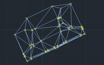
This tool creates a mesh of interconnected triangles by linking a selected set of points. This process forms a network of triangles suitable for surface modeling, terrain analysis, and spatial data interpolation. The resulting triangular mesh serves as a foundation for advanced GIS and CAD operations, ensuring precise representation of complex spatial structures.
Available for AutoCAD, BricsCAD, ZWCAD and GstarCAD.
1. Run SPMTRIANGULATION command
- Type SPMTRIANGULATION in the command line and press Enter or search for the tool in the ribbon or toolbar.
2. Select geometries
- Select the objects to triangulate manually, by query, table or layer.
- Set the output layer and specify the geometry type: borders (closed polylines) or polygons.
3. Review triangles
- Triangles will be generated based on the selected points.
Note: Some features are available only in the Standard or Professional editions.


