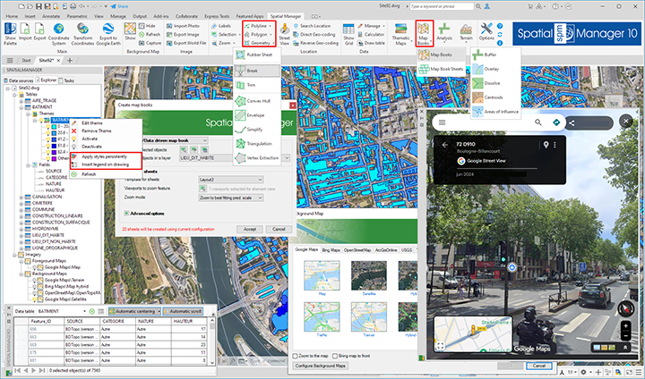
‘Spatial Manager’ version 10 has been released and improved according to the suggestions and needs of thousands of users in all application versions and platforms.
In v10 you will find the capability to create Map Books using powerful sheets definition tools, 16 new advanced GIS drawing and editing functions, such as Create Polylines from Points, Simplify geometries using Vertex Suppression, Divide Polygons, etc., add-ons to improve the information on maps such as Thematic Map Legends or Tables in the drawing from the Data Grid, and many more news and enhancements that will allow you to address tasks related to spatial and territorial design and analysis like never before.
You can review in detail the new features in ‘Spatial Manager’ through the following links, which provide access to many images and videos:
- Spatial Manager for AutoCAD
- Spatial Manager for BricsCAD
- Spatial Manager for ZWCAD
- Spatial Manager for GstarCAD
- Spatial Manager Desktop
Please, Download or update ‘Spatial Manager v10’ and enjoy the superb possibilities provided by this application for any user engaged in the development and analysis of spatial information, planning, civil engineering, surveying, landscaping, architecture, supplies, etc.
Note: Some features can only be found in the Standard or Professional editions. Some of them only apply to CAD versions and may not be available in older AutoCAD, BricsCAD, ZWCAD or GstarCAD versions
Take a look at the application Changelogs in order to review the complete list of News, Improvements and Fixes in this version:


