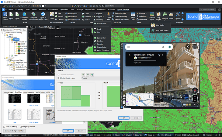
The recently released version 10.1 of ‘Spatial Manager’ is the first one compatible with BricsCAD 26. This new version includes a lot of functions and commands according to the suggestions and needs of thousands of BricsCAD users: Map Books, new advanced GIS drawing and editing functions, add-ons to improve the information on maps, such as Thematic Map Legends or Tables in the drawing from the Data Grid, and many more enhancements. ‘Spatial Manager for BricsCAD’ users will find on this version functionalities never seen in BricsCAD so far.
Import/export spatial or GIS data into/from BricsCAD (v13 to v26), and experience the advanced tools to manage spatial data, such as dynamic Multi Background Maps, Advanced GIS Edition, transform the drawing Coordinate System, quick drawing publishing in Google Earth, data structures and Data Grid, Data and Spatial Queries, Multi Labeling, Terrains, Search for locations and Geo-coding, Street View navigation, GIS Analysis and Fields Calculator, Thematic Maps, Map Books, etc.
Download or update ‘Spatial Manager for BricsCAD v.10.1’ and enjoy the superb possibilities provided by these applications tandem for any user engaged in the development and analysis of spatial information, planning, civil engineering, surveying, architecture, supplies, etc.
Want to learn more about ‘Spatial Manager for BricsCAD’? The following links will help you:
- Product page
- Technical Documentation
- YouTube channel
- Related Blog entries
- Download the commercial or trial version
Check out this complete summary about all the news and improvements in ‘Spatial Manager 10’


