Although the ‘Spatial Manager’ “Import-All” tool has already been discussed as part of a previous post in this Blog, it is important to review again this functionality, which allows you to easily launch unattended batch import processes
Related videos: AutoCAD / BricsCAD / ZWCAD
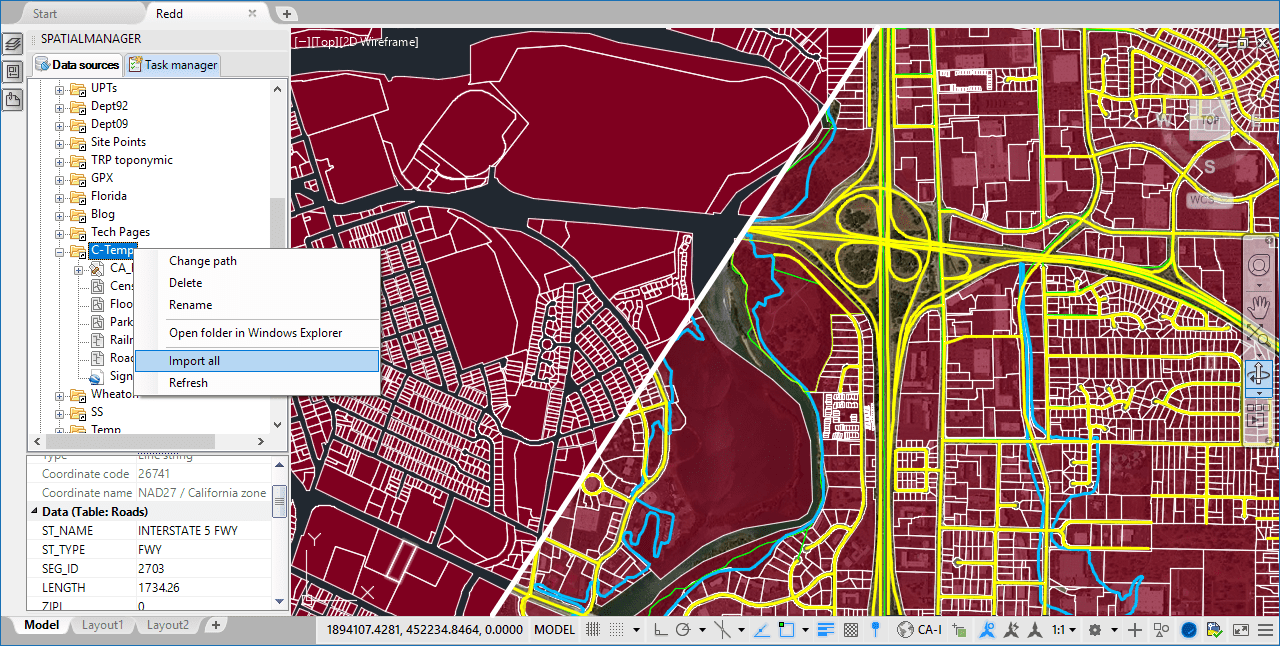
Import-all tool – ‘Spatial Manager’
Located in the right-click menu of any folder in the application palette, this powerful tool will allow you to import at once any compatible geospatial files found in the folder
These batch processes have no limitation on the number of files to be imported or their size. Neither are they limited to importing files defined using the same Coordinate System, since the Coordinate Transformation functionality is activated automatically by considering the sources and target (drawing) reference data
Thanks to these advanced features, the tool allows you to simultaneously import as many files Shape (SHP), KML/KMZ (Google Earth), OpenStreetMap, GML, IMKL, CSV, GPX (GPS), etc., as you want to. In addition, you can also distribute their content in different Layers or Fill the polygonal objects for easy identification
Please, take a look at the above videos to see how “Import-all” works in a real city map sample
Learn more about Importing geo-spatial data into your drawings:
- Blog:
- Technical Documentation:


