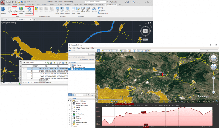
Google Earth includes a little-known function that allows you to analyze the elevation profiles of roads, streets, highways, railways, paths, etc. polylines. The tools for export/publish to KML or KMZ files from your flat 2D (or 3D) drawings and maps provided by ‘Spatial Manager’ (AutoCAD, BricsCAD, ZWCAD or Desktop), will enable you to easily perform this analysis from you own data
Related videos: AutoCAD / BricsCAD / ZWCAD / Desktop
As you can see in the videos and image above (click on the image to enlarge it), using ‘Spatial Manager’ you can export a whole drawing or map, as well as selected objects or any layer, to Google Earth KML or KMZ files. The export process will include not only the graphic objects but also any data associated with these objects, which can also be visualized and processed in Google Earth
When you open the exported file in Google Earth, you will be able to select any object in order to review its associated data and, through the right button on the object, analyze the elevation profiles for the chosen object in the map itself and in a profile graph that will be open at the bottom of the window
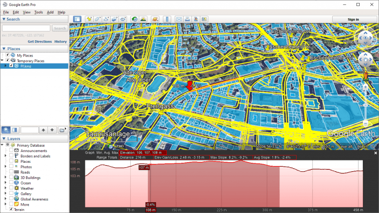
As you move along the object on the map, you will get the following information for the specific point where you are on the polyline:
- On the map itself, near the point
- Distance to the start of the road
- Altitude of the road at this point
- Slope of the road at this point
- On the lower profile graph, in the lower window area
- Same 3 previous data, and for the whole road:
- Minimum, average and maximum elevations
- Total length
- Elevation Gain/Loss
- Maximum and average slopes
- Same 3 previous data, and for the whole road:
As you will see in the second section of the videos, and in the following image (click on the image to enlarge it), you can hold down the mouse button as you move along the road to display the previous values for a selected section of the road instead of the whole road
Also in this second section you will see how, if you need add roads or streets information in your drawing or map, ‘Spatial Manager’ will be able to import it from OpenStreetMap and many other spatial data sources
Learn more about exporting to KML/KMZ in the ‘Spatial Manager’ technical Wiki:
- Spatial Manager for AutoCAD
- Spatial Manager for BricsCAD
- Spatial Manager for ZWCAD
- Spatial Manager Desktop
Note: In ‘Spatial Manager’ for CAD versions (AutoCAD, BricsCAD and ZWCAD), the full export functionality can only be found in the Professional edition. The publishing to Google Earth functionality is found in the Standard and Professional editions


