The Export functionality allows the ‘Spatial Manager’ users to communicate from AutoCAD or BricsCAD with a world of applications and many other users in the Spatial, Geographical and GIS disciplines. It is the main differential feature in the ‘Professional Edition’ of the applications and it is continuously being improved
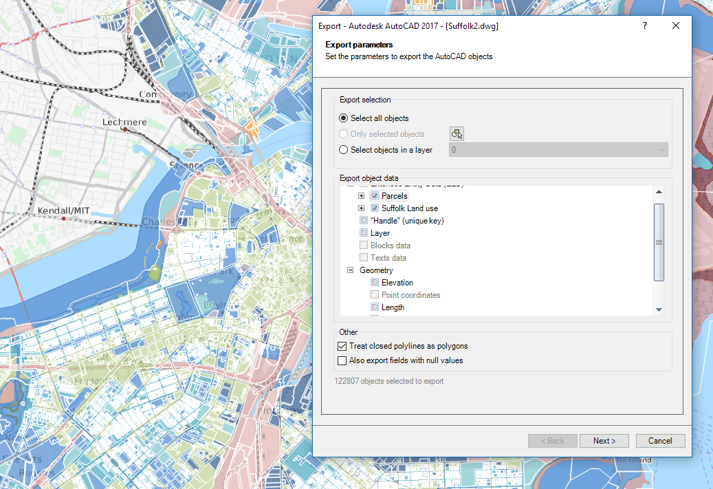
Export parameters window
Related videos: AutoCAD / BricsCAD
Note: some of the command features you can read below may not be included in the videos
New Export features and options:
- Select the data Tables and Fields to export
- Option to export the X/Y/Z coordinates of the objects
- Advanced management of duplicate fields
- Option to export the rotation and scales of Blocks
- Now you can export the Length and Area of the objects
- The Export Options window has been rearranged and expanded to group the options relative to geometric data
- Upon completion of any export process to a file you can now directly open the file location
- When exporting to a KML or KMZ file you can now directly open the file in Google Earth (if installed)
Editions Note: The Export functionality is available in the “Professional” edition only


