The ASCII data files (often named “Comma-separated values” CSV), are one of the most common types of files to store Points tabular data. They are plain-text ASCII files, without binary numbers or any other data type that has to be interpreted
Related videos: Desktop / AutoCAD / BricsCAD
Every line in the file corresponds to a record of a data table and every text or number between two delimiter characters in a line corresponds to a field in this record. Various characters may be used as delimiter characters and the most commonly used are the comma, the tab, the space character or the semicolon
Importing Points from a CSV file
The file extensions used for these type of files are CSV, XYZ, TXT, ASC, and some others, and their content may fit standard formats (XYZ, XY Description, PNEZD – GPS, Code XY. etc.), although the format may also be outside these standards
Enhanced data provider
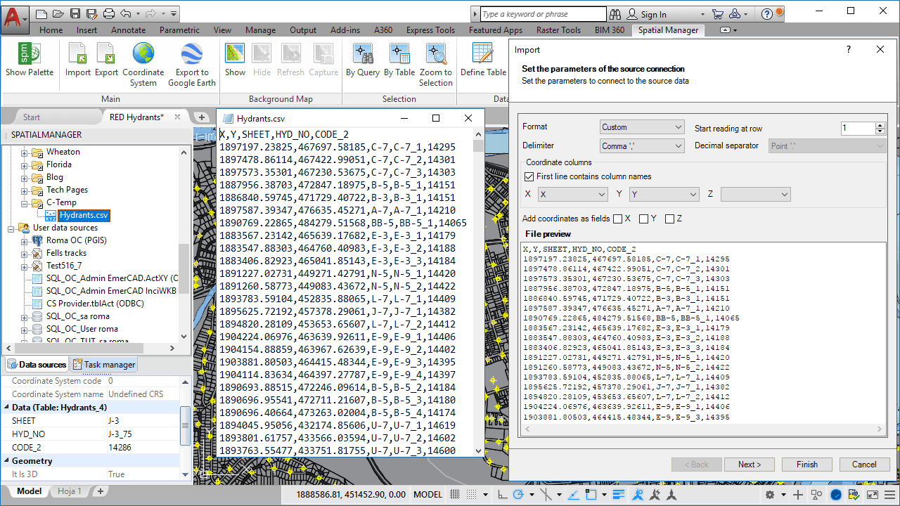
The “Enhanced ASCII data provider” (included in the v.4 of the applications) adds the option to work with “Custom” format files, in which some data fields (2 or 3) are for the coordinate values (X/Y/Z) and the rest of the fields include other data (please take a look to the above image)
As you can see in the related videos, the first line in the file may include the field names. In this case, the selection of the coordinate fields may be automatic because the application looks for names such as X, LON, LONGITUDE, Y, LAT, LATITUDE, Z/H (case insensitive)
Please, go to the Documentation if you want to learn more about Loading (Desktop) or Importing (AutoCAD/BricsCAD) spatial data:
· Spatial Manager Desktop
· Spatial Manager for AutoCAD
· Spatial Manager for BricsCAD


