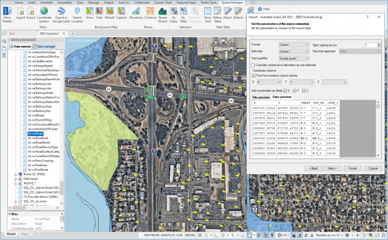
The ASCII data provider supplied with ‘Spatial Manager’ allows you to Import/Export geospatial data from/to CSV, XYZ, TXT, ASC, NEZ, UPT, etc. files, and with very little added work, it is also valid for Excel, Access, etc. files. It has now been enhanced in order to preview the file contents and the configured provider parameters in a Tabular form
Related videos: AutoCAD / BricsCAD / ZWCAD / Desktop
In addition to preserving the option to preview the contents of the “raw” file, this new option to preview the Table will make it easier to configure any of the options that you can find in this powerful data provider
In addition, the option of considering several consecutive data delimiters as one has been included. So, for example, if “space” is the chosen delimiter, the successive spaces which separate two data will be considered as only one
In the above videos you can see how this new options work through the example of importing a points CSV file (Hydrants in a city), in which you will also see other advanced import options, such as the use of Block with Attributes, which will take their values from data columns in the CSV file. Please, take a look
Learn more about Importing or Loading data in the ‘Spatial Manager’ technical Wiki:
- Spatial Manager for AutoCAD
- Spatial Manager for BricsCAD
- Spatial Manager for ZWCAD
- Spatial Manager Desktop
Take a look at all the news and improvements in ‘Spatial Manager 6.2’


