The KML or KMZ files of Google Earth can include some little-known parameters which apply to the Features they contain. One of these parameters is the Altitude of the Features
By using the Altitude parameter, the Features can be placed at a certain height above the ground (even considering the slopes of the ground) or above sea level, and extend the sides to ground, when importing or viewing them using Google Earth. This allows, for example, to get the volume of the buildings in a city or a part thereof in a schematic basis quickly
The data Provider for Google Earth File (KML or KMZ), which incorporates Spatial Manager Desktop™, has recently been enhanced to include this interesting parameter, allowing the generation of Features including their real heights within such files, as shown in the next picture:
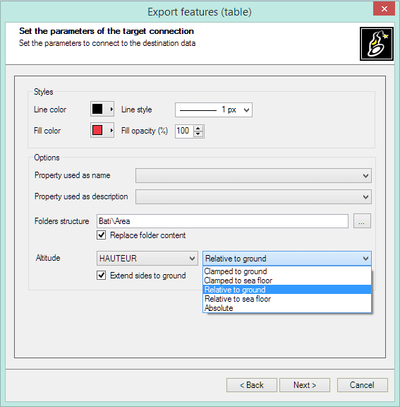
In the sample analyzed in this video, some buildings of a city are exported to a KML file from a Map Layer whose data table includes the height of the buildings
Please watch the video:


