Spatial Manager Blog : Raster (page 2)

Exporting-Importing user Background Map definitions
‘Spatial Manager’ dynamic Background Maps functions allow you to use preset maps (Bing, MapBox, OpenStreetMap, etc.), but also define and group your own maps by accessing public, administration or enterprise WMS, WMTS or XYZ/TMS servers (Google Maps, Municipalities, Gov. Agencies,... more

Importing geo-referenced Raster Images
Raster geo-referenced image files are widely used by anyone working in GIS or Mapping environments because they can include orthophotos, scanned geographic areas or details, information overlays, etc. Although almost all CAD applications have tools for attaching raster images... more

Reducing images size when Publishing to Google Earth
Under certain conditions, displaying large images on ‘Google Earth’ may cause problems. These images can be replaced by a “cross” in order to indicate that the real image cannot be loaded on the map. Other times, images may be... more

Geo-referencing captured images from Maps
Capturing raster images from Dynamic Background Maps in ‘Spatial Manager’ (CAD editions) allows you to generate static images (snapshots) from the current Map view. In the latest application update (v.4.2), this function has been improved in two ways... more

Exporting images to Google Earth too
Although ‘Publishing to Google Earth’ from a drawing (AutoCAD, BricsCAD or ZWCAD) is one of the most popular features among the ‘Spatial Manager’ users, very few are aware of the possibility of including attached images in the drawing as part... more
Snapshots of Background maps
Now Spatial Manager™ for AutoCAD or BricsCAD includes the command SPMBGMAPIMAGE that allows you to create (capture) a Raster Image corresponding to the display view of the current ‘Background Map’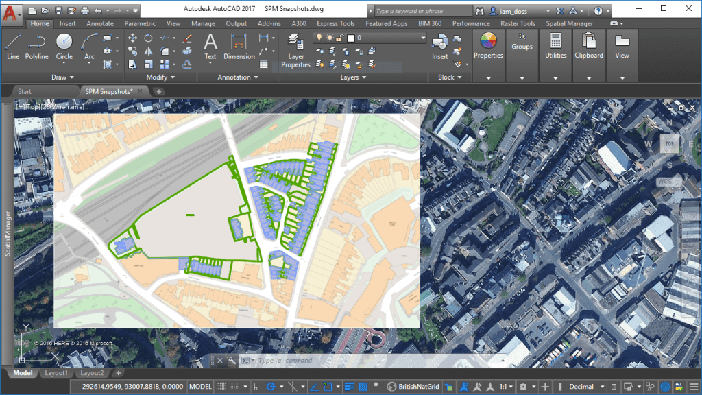 more
more