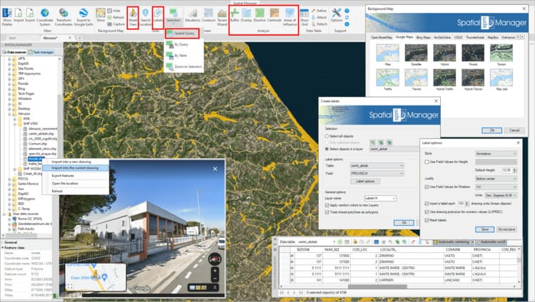
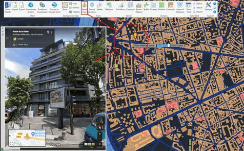
New version 7 of ‘Spatial Manager’ has been released and it comes full of new functions and improvements, that will allow you to be much more productive in the development of any project, analysis or work related to territorial and geographic information. We invite you to take a look at this blog entry and the related video in order to learn at a glance about the possibilities of the new Street View palette, the advanced tools for GIS and object selection, and many other interesting features
New features and improvements:
- Street View - New AutoCAD/BricsCAD/ZWCAD/GstarCAD palette for displaying (and navigate) dynamic Google Street View images on any drawing/map
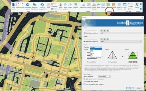
- GIS analysis tools - Advanced geometric and data operations for creating new objects from analysis processes
- Buffer: Buffered polygons around point objects, linear objects or polygon boundaries
- Overlay: New objects based on geometric and data operations between existing object groups (Intersect, Union, Erase, Identity, Clip, Paste or Symmetric Difference)
- Dissolve: New polygons based on the grouping of other adjacent polygons with some common data
- Centroids: Polygon Centroids creation by adopting the polygons data
- Areas of Influence: Polygons defined by the set of points closest to each point of a selection of points in the drawing (Voronoi diagrams)
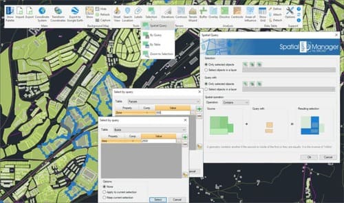
- Spatial Query Selection - Advanced object selection system based on geometric and data operations between existing object groups (Intersect, Touches, Within, Contains, Disjoint, Overlaps or Crosses)
- Object Labeling - Texts based on objects data
- Other
- User-selected location and name for image files resulting from Background Map captures
- Transparent dynamic Background Map regeneration on view changes (Zooms, Pan, etc.) even if another command is running
- Option to label linear objects at a single point and not only by means of repeated labels along the length of the object
- GPX (GPS) data provider now also supports writing
- New provider for reading Esri ASCII Grid files
- Data related selection options (by Table and by Query) in the commands that allow selecting objects (Export, Publication to Google Earth, etc.)
- Simultaneous removal of several Fields in Data Table definitions
- Optional selection of the required Grid files for a Coordinate Transformation using Grids
- Updated main Esri projected coordinate systems (ArcGIS 12.8) and EPSG tables (version 10.026)
- Revamped interface layout and icons design
- AutoCAD 2022, BricsCAD 21, ZWCAD 2022, GstarCAD 2021 compatible
- … and more
Enjoy the video
Note: Some features can only be found in the Standard or Professional editions. Some of them only apply to CAD versions and may not be available in older AutoCAD, BricsCAD, ZWCAD or GstarCAD versions
Take a look at the application Changelogs in order to review the complete list of News, Improvements and Fixes in this version:


