The “spring” version of ‘Spatial Manager’ (4.2) adds the news, improvements and fixes developed over the past six months. Enjoy the georeferenced Raster images provider, which transform images individually or in batches, the LiDAR provider, the practical ‘Import-all’ enhancements, the import/export Hatches options, as well as the full compatibility with the latest base systems on the market
‘New ‘Spatial Manager 4.2’ Raster Images provider
New features and improvements:
- Very useful for maps that include transparent areas
- Related video: AutoCAD / BricsCAD / ZWCAD / Desktop
- Related Blog entry
- Choice of the image format
- Generation of the geo-reference file (World File)
- Related video: AutoCAD / BricsCAD / ZWCAD
- Related Blog entry
- New LiDAR files data provider
- Related video: AutoCAD / BricsCAD / ZWCAD
- Related Blog entry
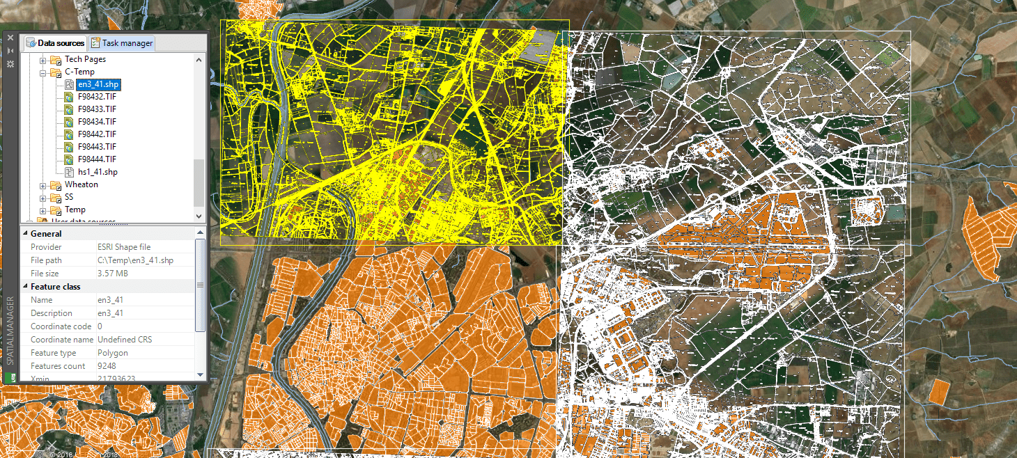
- New georeferenced Raster images data provider
- References via “World File” (TFW, JGW, etc.) or GeoTIFF
- Related video: AutoCAD / BricsCAD / ZWCAD
- Related Blog entry
- Name, Angle, Scale, etc.
- Related video: AutoCAD / BricsCAD / ZWCAD
- Related Blog entry
- Related video: AutoCAD / BricsCAD / ZWCAD
- Related Blog entry
- Compatible with the new data providers for LiDAR files and Raster images
- Select from among several options the CRS of unreferenced data sources to import
-
Distribute the objects in Layers according to the source Table name
- Interesting for files that can contain several tables (SDF, SQLITE, etc.)
- Related video: AutoCAD / BricsCAD / ZWCAD
- Related Blog entry
- English, French, German, Portuguese, Russian, Spanish
Note: Some functionalities only apply to CAD versions, and some of them may be found only in the Standard or Professional editions
Take a look at the application Changelogs in order to review the complete list of News, Improvements and Fixes in this version:


