LiDAR (Light Detection And Ranging) is a surveying method that measures distance to a target by illuminating the target with pulsed laser light and measuring the reflected pulses with a sensor. Differences in laser return times and wavelengths can then be used to make digital 3-D representations of the target. ‘Spatial Manager’ adds from the version 4.2 a data provider to read / load LiDAR points
Related videos: AutoCAD / BricsCAD / ZWCAD
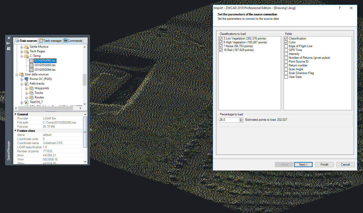
‘Spatial Manager’ Import LiDAR data provider
You can now import 3D-point features into your drawings from LAS or LAZ files and select which Object Classifications you want to read. You will also be able to choose which data fields will be imported and the point-cloud percentual density, which allows you to control the maximum number of points to load. Both the classifications as well as the available fields or the total number of points in the file are automatically read when the file is opened
The LiDAR data provider has been included into all ‘Spatial Manager’ suite applications and it works as any other points importing data provider: 3D support, separate points by Layer based on any field values, thematic Layer colors, use Points or Block References, geographic filtering, Transform the Coordinates between different systems, etc.
And, as you can see in the above videos, LiDAR is also supported by the ‘Import-All’ functionality, which allows the bath import of LiDAR grids even together with other spatial data sources (Raster images, Shapefiles, etc.). In this case, the cloud density is set to 200,000 points for each imported file
Learn more about Importing from a wide range of spatial data sources into your drawings:
Take a look at all the news and improvements in ‘Spatial Manager 4.2’


