In a recent post of this Blog (see the link below) we reviewed the exciting possibilities of the ‘Import-all’ function in the CAD versions of ‘Spatial Manager’ (AutoCAD/BricsCAD/ZWCAD). This function has since undergone some interesting improvements
Related videos: AutoCAD / BricsCAD / ZWCAD
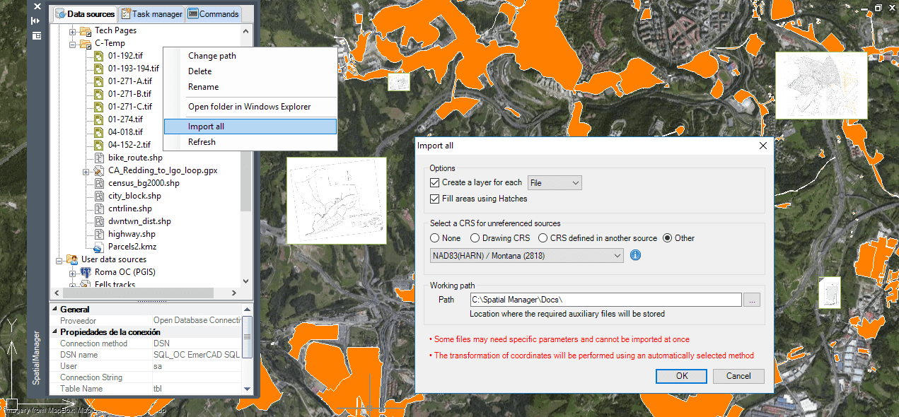
New ‘Import-All’ options and parameters
First, the function has been made compatible with the latest application data providers for LiDAR point clouds and for geo-referenced Raster Images. This means that you can import into a drawing as many LiDAR or orthophoto grids as you wish in a single operation, and transform them if necessary according to the coordinate transformation to be applied!
On the other hand, it is now possible to assign automatically a Coordinate System (CRS) for those sources to be imported that are not referenced. This can often happen with the Raster Images we have discussed, but also with Shapefiles or other sources that lack this information. You can select this CRS “by default” from the CRS assigned to the drawing (if any), from another source CRS to import (if any has it defined) or select another one from the application CRS catalog
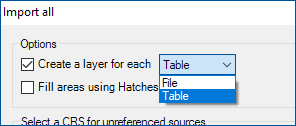
Finally yet importantly, there is a new option to separate the imported objects by Layers according to the names of different Tables in the files to be imported. In previous versions there was already the other option of separating according to the names of the files to be imported (an option that is maintained), but this new option allows separating when importing “multi-table” files, such as SQLite, GPX and others
Please have a look at the above videos, which show these improvements
Related Blog entry: The powerful ‘Import-all’ tool
Take a look at all the news and improvements in ‘Spatial Manager 4.2’


