Capturing raster images from Dynamic Background Maps in ‘Spatial Manager’ (CAD editions) allows you to generate static images (snapshots) from the current Map view. In the latest application update (v.4.2), this function has been improved in two ways
Related videos: AutoCAD / BricsCAD / ZWCAD
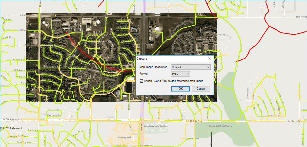
Background Map Snapshot options
On the one hand, it is now possible to choose the file format for the created raster image. You can select this parameter among PNG (only option before), JPG or TIF files
Moreover, and more important than the previous one, now the user can geo-reference the resulting raster image. The standard system chosen to reference the image is by creating an attached “World File” to the image (TFW, JGW or PGW), which allows you to use the pair of files in many of the CAD or GIS systems with the ability of applying this information to properly position the image
These two enhancements will also help you better share your geographic information with other users
Learn more about ‘Background Maps’ Snapshots in ‘Spatial Manager’:
Take a look at all the news and improvements in ‘Spatial Manager 4.2’


