For designers and users of geographic information in all its scope, the use of different shapes and sizes of polygonal fills allows to quickly and visually differentiate areas of a map that represent different phenomena, conditions or status: population densities, types of buildings, land use, etc.
Related videos: AutoCAD / BricsCAD / ZWCAD
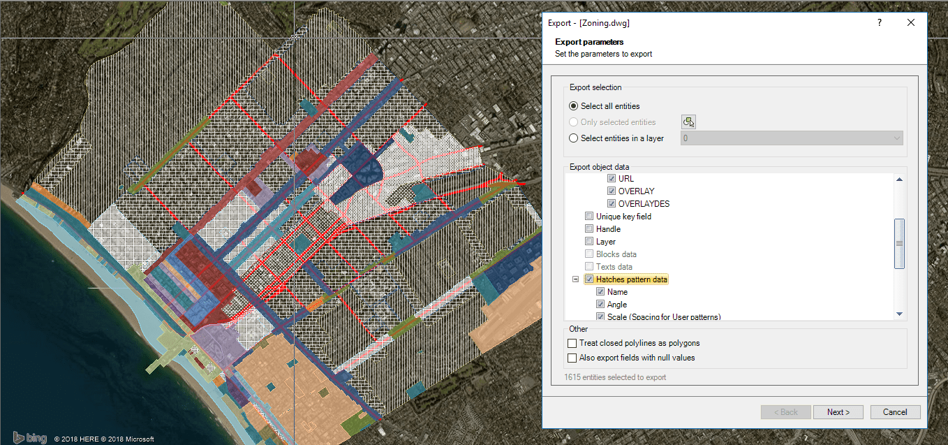
Exporting polygon objects including Hatches properties
CAD users are very familiar with the utilization of Hatches in their map drawings, and now ‘Spatial Manager’ allows them to manage data related to the properties of Hatches when exporting or importing spatial information
When exporting objects from a drawing to any target (Shapefiles, Google Earth, SQL, PostGIS, etc.), it is now possible to select in the Exporting Parameters window all or some of the Hatches Properties to be exported as polygons, if any in the drawing
You will be able to put in the data table resulting from the export process, the Names of the Patterns, their Scales, Rotations, or even particular data of User-defined Patterns, such as Spacing and whether they are Double frames or not
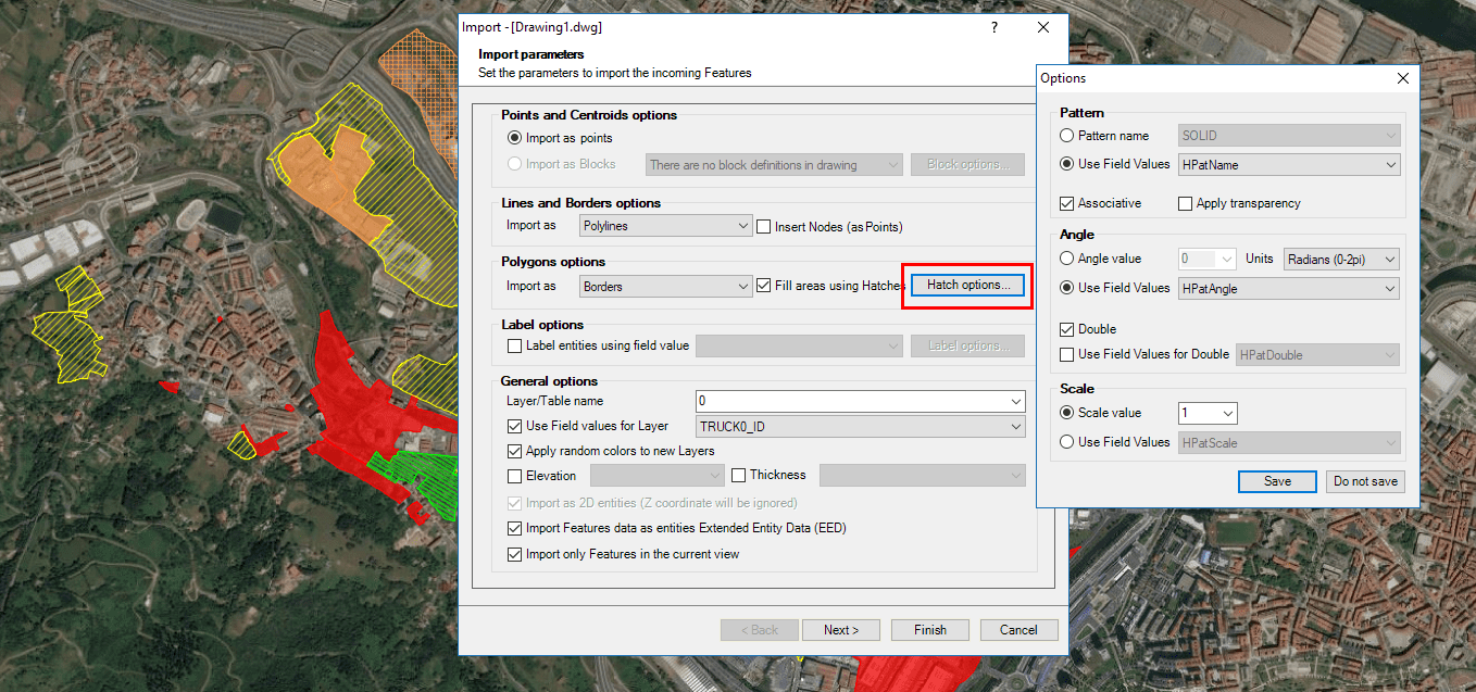
Retrieving Fill properties from incoming data
As a more or less inverse functionality, when importing polygonal elements in a drawing you will be able to set the properties of their fills from variable values according to data fields of the incoming table. Here you will also be able to choose the necessary data to configure the Names, Scales, Rotations, etc. of the Hatches to be used
Please have a look at the above videos if you want to learn more about the new Hatches Properties management in ‘Spatial Manager’
Learn more about Importing from spatial data sources into your drawings:
Take a look at all the news and improvements in ‘Spatial Manager 4.2’


