Opciones de geometría en BricsCAD
Importa como puntos o bloques, rellena polígonos o crea centroides
Descubre todo el potencial de este conjunto de herramientas diseñado para mejorar la integración y edición de datos GIS dentro de BricsCAD.
Utilice bloques basados en campos para puntos y centroides
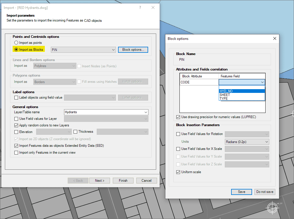
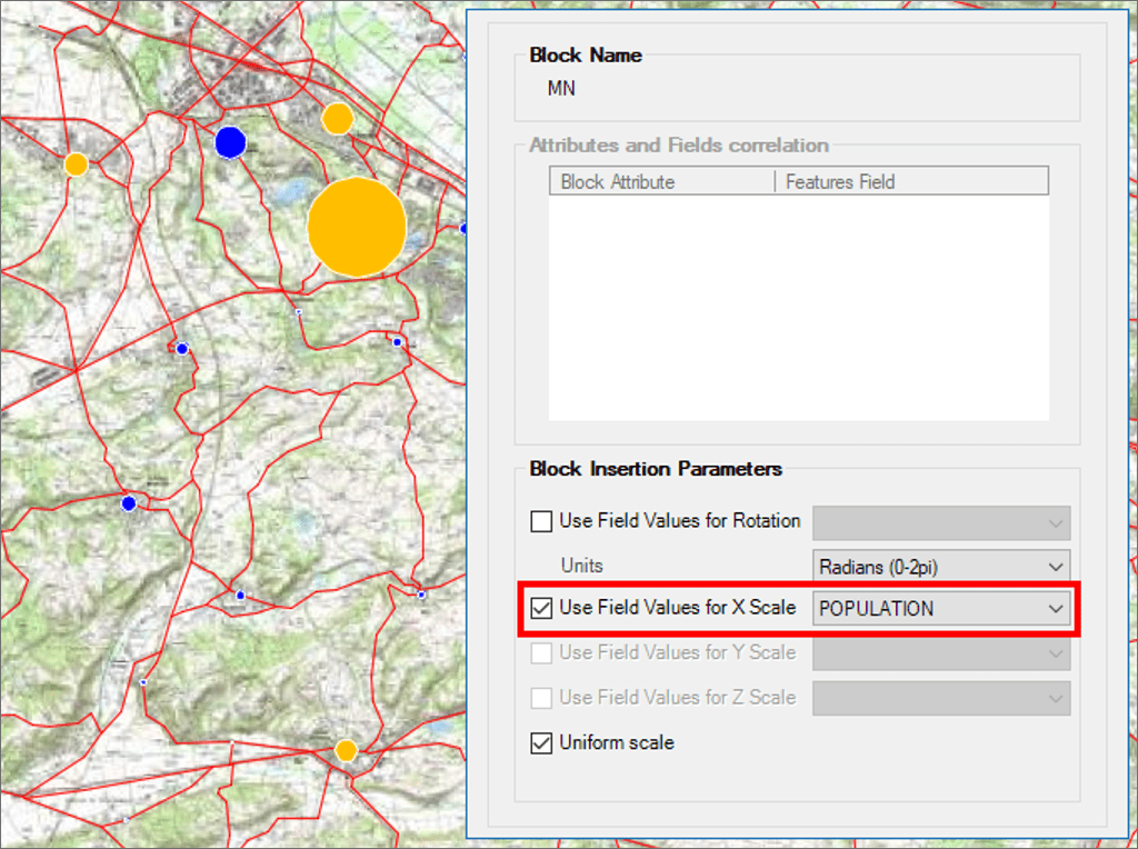
Parámetros de inserción de Bloques según valores de campos
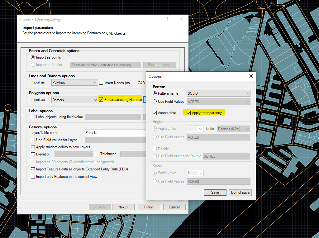
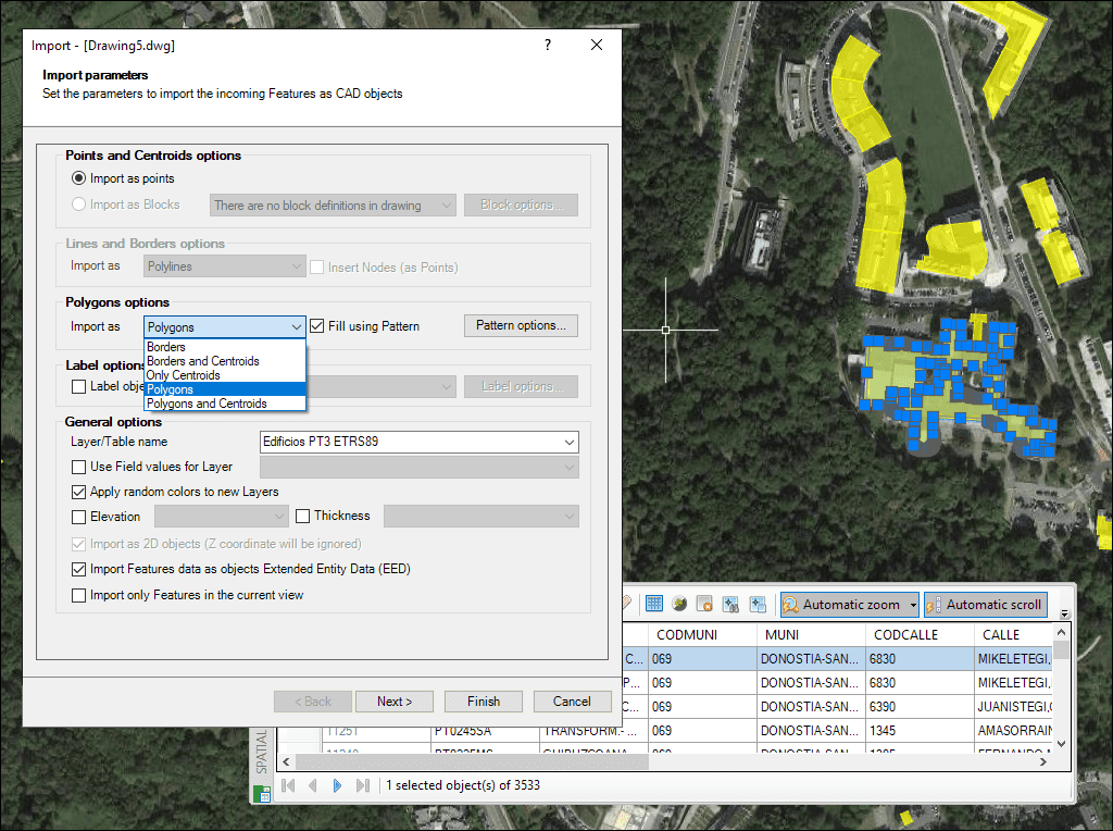
Rellenos de polígonos y transparencias
Creación de centroides de polígonos durante la importación
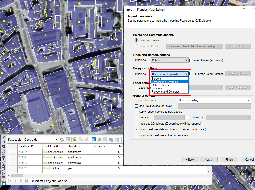
Polígonos múltiples
Import Google Earth objects into BricsCAD
How to import shapefiles into BricsCAD
Import coordinates from Excel to BricsCAD
Import CSV into BricsCAD
Import KML to BricsCAD
Import points into BricsCAD
Ordnance Survey in BricsCAD
Import OpenStreetMap data into BricsCAD
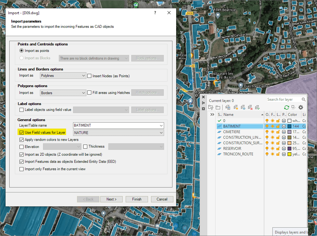
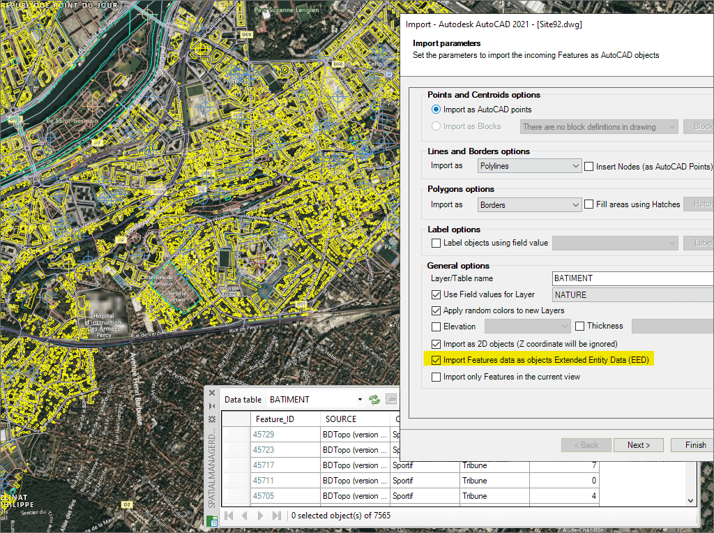
Importa datos como XDATA para dibujos de BricsCAD más inteligentes
* Disponible únicamente en las ediciones Standard y Professional
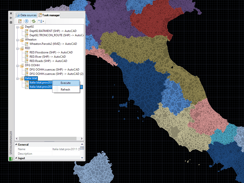
Guarde Tareas en BricsCAD para reproducir los procesos de importación (incluyendo todos los parámetros del proceso) tantas veces como desee
* Disponible únicamente en la edición Professional
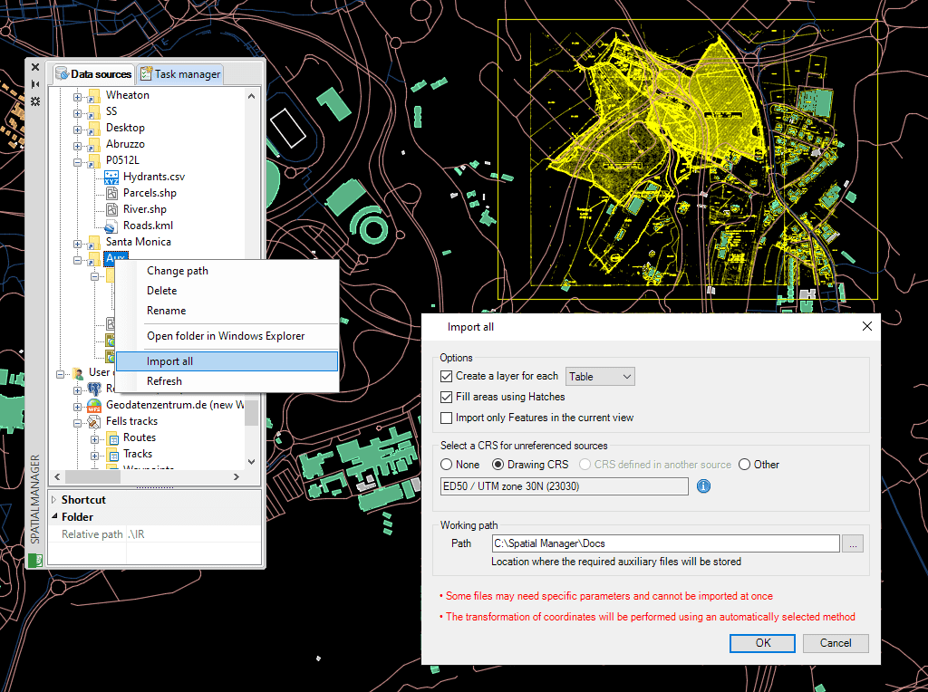
Importa datos fácilmente con asistentes, paletas o herramientas por lotes
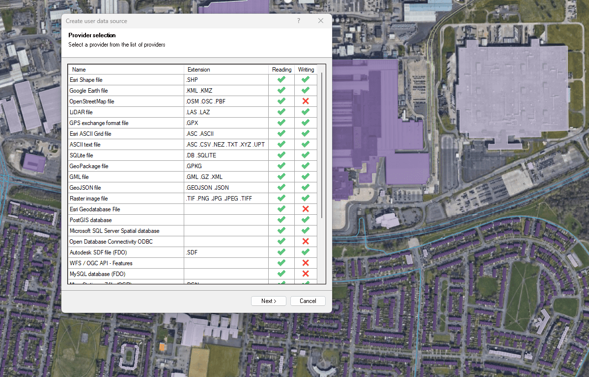
Conecta con una amplia variedad de fuentes de datos espaciales

Access and import authoritative LINZ (Land Information New Zealand) vector datasets directly into your DWG through the LINZ WFS (Web Feature Service). Spatial Manager connects to the WFS endpoint and... more

Download and import official Land Information New Zealand (LINZ) data into a DWG using Spatial Manager, either through open services (WFS / OGC API Features) or distributed files (SHP, GeoJSON,... more

View detailed, high-resolution LINZ background maps directly in your DWG through WMTS services–no prior tile download required. Spatial Manager connects to the LINZ WMTS endpoint, requests only the tiles needed... more

OGC API Features is a modern, RESTful standard developed by the Open Geospatial Consortium (OGC) for accessing and managing geospatial feature data over the web. It is the evolution of... more