Importation de données dans BricsCAD
Importez des données en tant que XDATA pour des dessins BricsCAD plus intelligents
Découvrez tout le potentiel de cet ensemble d’outils conçu pour améliorer l’intégration et l’édition des données SIG dans BricsCAD.
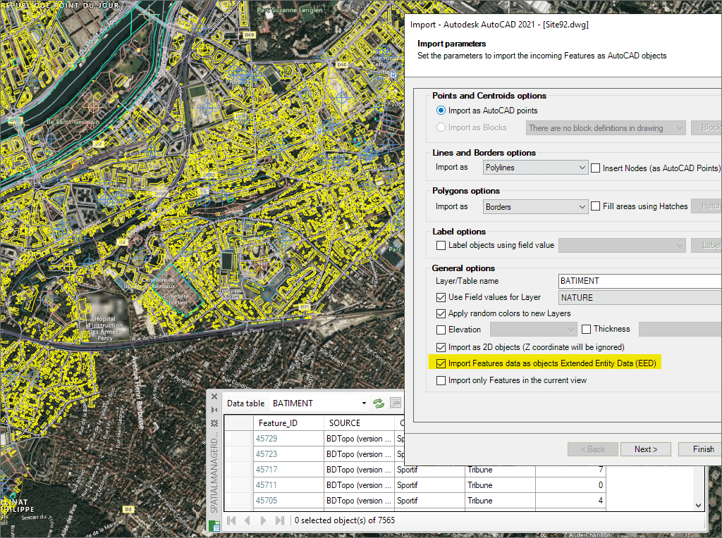
Importer des données de tables comme XDATA (EED)
Import Google Earth objects into BricsCAD
How to import shapefiles into BricsCAD
Import coordinates from Excel to BricsCAD
Import CSV into BricsCAD
Import KML to BricsCAD
Import points into BricsCAD
Ordnance Survey in BricsCAD
Import OpenStreetMap data into BricsCAD
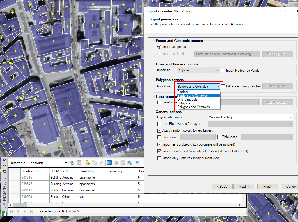
Importer sous forme de points ou de blocs, remplir les polygones ou créer des centroïdes
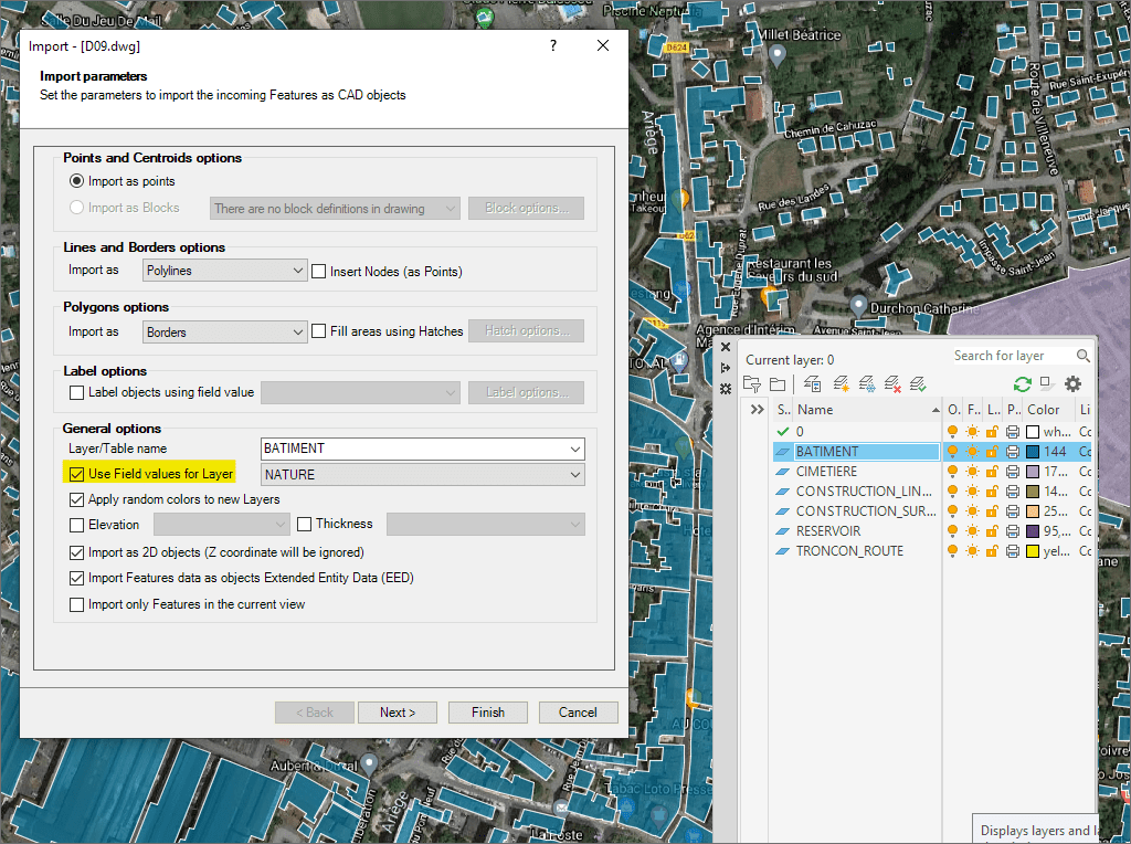
Assignez des calques, étiquetez les objets, filtrez spatialement et définissez l’élévation
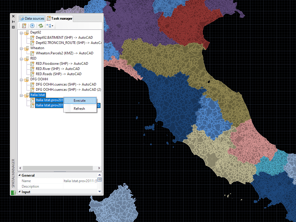
Enregistrez des Tâches dans BricsCAD pour reproduire les processus d'importation (incluant tous les paramètres du processus) autant de fois que vous voulez
* Sont disponible que dans le édition Professional
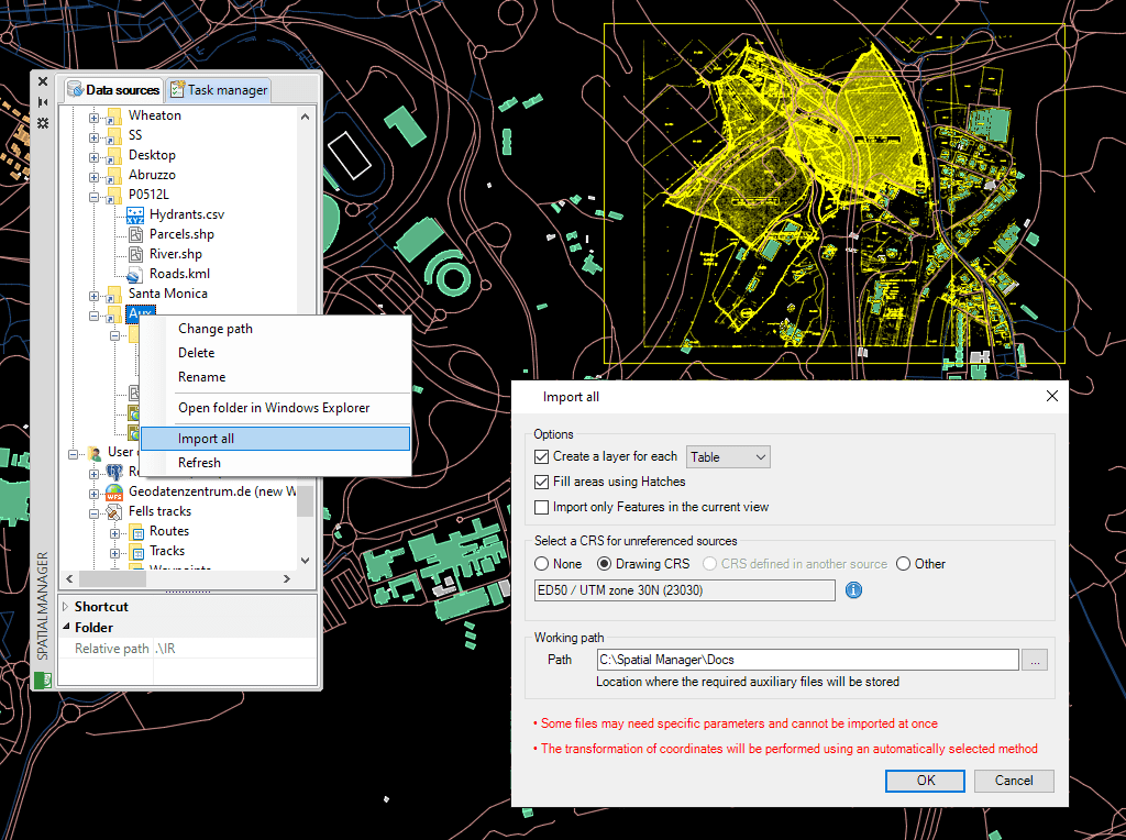
Importez facilement des données via des assistants, palettes ou outils par lot
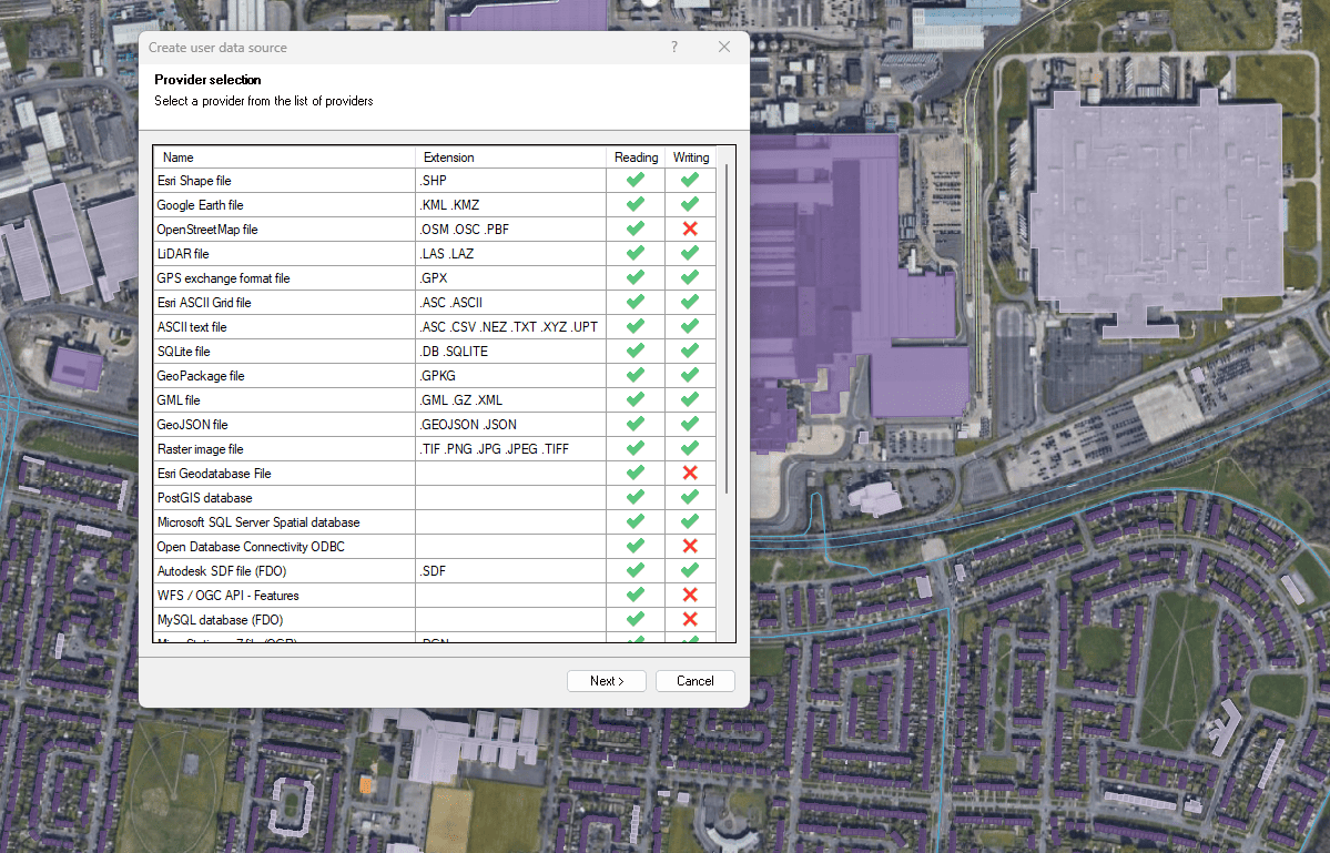
Connectez-vous à une grande variété de sources de données spatiales

Access and import authoritative LINZ (Land Information New Zealand) vector datasets directly into your DWG through the LINZ WFS (Web Feature Service). Spatial Manager connects to the WFS endpoint and... more

Download and import official Land Information New Zealand (LINZ) data into a DWG using Spatial Manager, either through open services (WFS / OGC API Features) or distributed files (SHP, GeoJSON,... more

View detailed, high-resolution LINZ background maps directly in your DWG through WMTS services–no prior tile download required. Spatial Manager connects to the LINZ WMTS endpoint, requests only the tiles needed... more

OGC API Features is a modern, RESTful standard developed by the Open Geospatial Consortium (OGC) for accessing and managing geospatial feature data over the web. It is the evolution of... more