Using base maps (roads, aerial, etc.) from imagery providers allows, not only the composition of more attractive Maps in mapping applications, but also the use of these base images as a practical reference system or a powerful tool for checking on the Maps
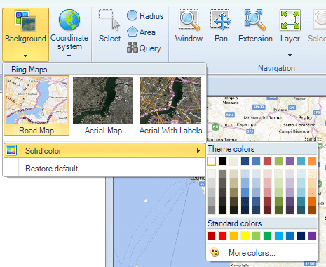
The Maps background technology in Spatial Manager Desktop™ includes, in addition to the solid background color, access to base maps downloaded from the appropriate imagery provider, performing automatic re-calculation of the image grids in the Map. All functions relating to viewing, printing or copying Maps, consider the configured background for a correct representation of these Maps
In the following example, we will use some Bing maps, integrated into the application, as Map backgrounds in a sample Map, and, in addition to the changes between the base maps, you will see how the image grids are re-calculated according to the different scales of the Map
Please, watch the video:


