Geometrieoptionen in BricsCAD
Als Punkte oder Blockreferenzen importieren, Polygone füllen oder Schwerpunkte erzeugen
Entdecken Sie das volle Potenzial dieses Werkzeugsatzes, der entwickelt wurde, um die Integration und Bearbeitung von GIS-Daten in BricsCAD zu verbessern.
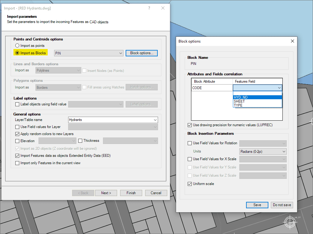
Verwenden Sie feldbasierte Blöcke für Punkte und Schwerpunkte
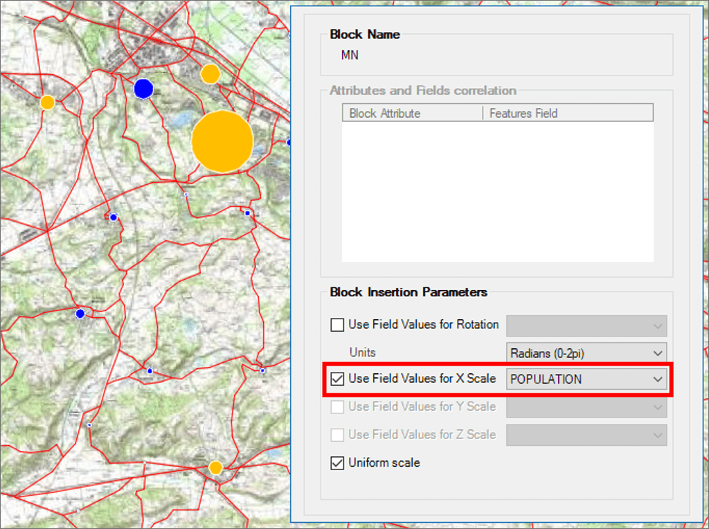
Block-Einfügeparameter aus Feldwerten
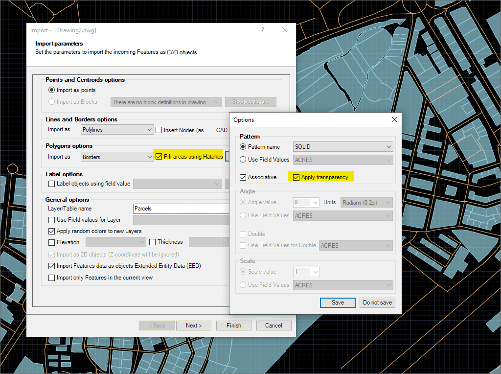
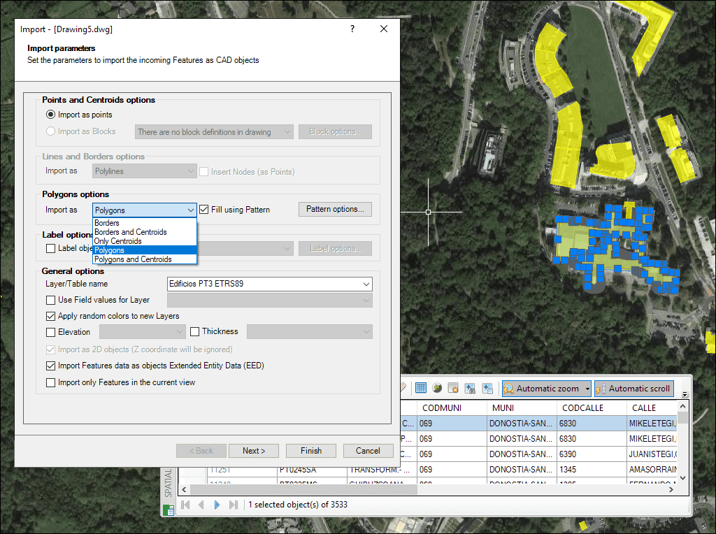
Polygonfüllungen und Transparenzen
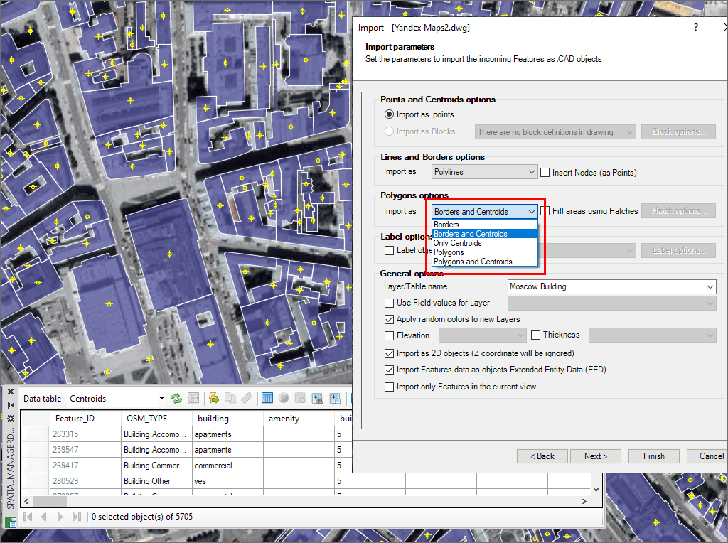
Erstellung von Polygonschwerpunkten beim Import
MPolygone
Import Google Earth objects into BricsCAD
How to import shapefiles into BricsCAD
Import coordinates from Excel to BricsCAD
Import CSV into BricsCAD
Import KML to BricsCAD
Import points into BricsCAD
Ordnance Survey in BricsCAD
Import OpenStreetMap data into BricsCAD
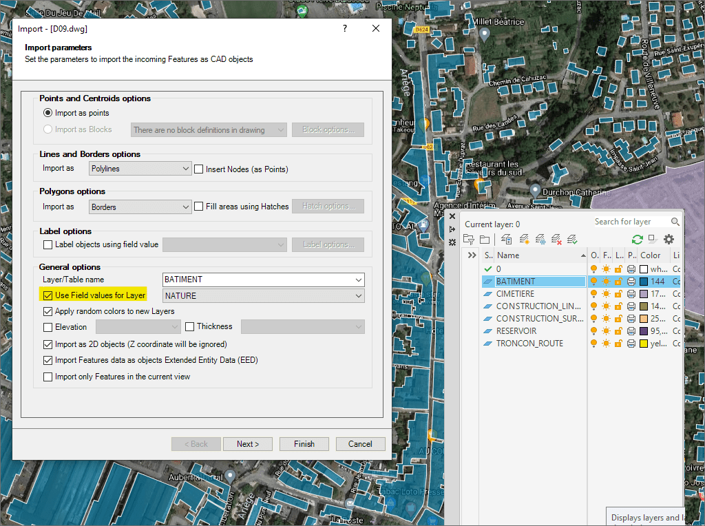
Weisen Sie Layer zu, beschriften Sie Objekte, filtern Sie räumlich und steuern Sie die Höhe
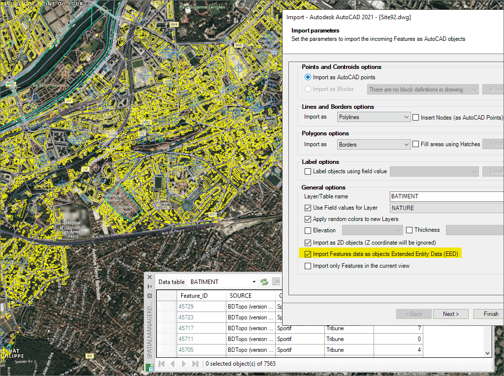
Importieren Sie Daten als XDATA für intelligentere BricsCAD-Zeichnungen
* Nur in der Standard und Professional Edition verfügbar
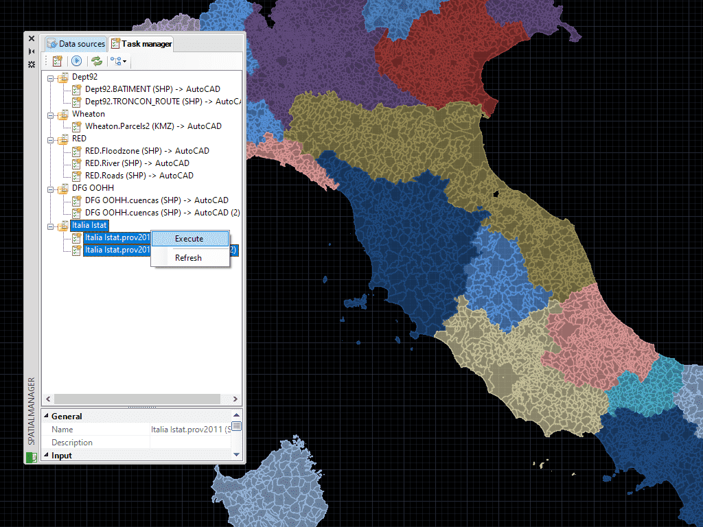
Speichern Sie Aufgaben in BricsCAD, um Import-Prozesse (einschließlich aller Prozessparameter) so oft wie gewünscht erneut auszuführen
* Nur in der Professional Edition verfügbar
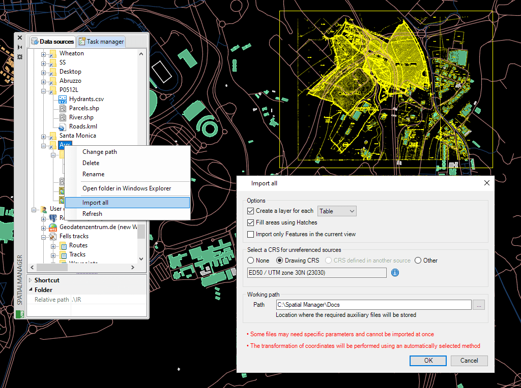
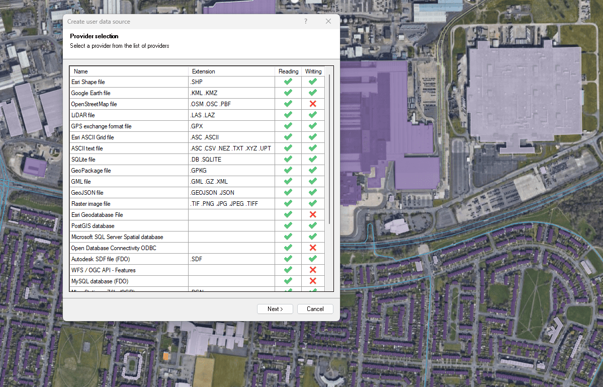
Verbinden Sie sich mit einer Vielzahl räumlicher Datenquellen

Access and import authoritative LINZ (Land Information New Zealand) vector datasets directly into your DWG through the LINZ WFS (Web Feature Service). Spatial Manager connects to the WFS endpoint and... more

Download and import official Land Information New Zealand (LINZ) data into a DWG using Spatial Manager, either through open services (WFS / OGC API Features) or distributed files (SHP, GeoJSON,... more

View detailed, high-resolution LINZ background maps directly in your DWG through WMTS services–no prior tile download required. Spatial Manager connects to the LINZ WMTS endpoint, requests only the tiles needed... more

OGC API Features is a modern, RESTful standard developed by the Open Geospatial Consortium (OGC) for accessing and managing geospatial feature data over the web. It is the evolution of... more