Daten importieren
Importiert räumliche Daten in neue oder vorhandene GstarCAD-Zeichnungen als GstarCAD-Objekte und Erweiterte Entitätsdaten (EED)
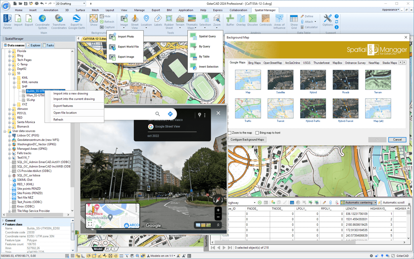
Verfügbar in Englisch, Deutsch, Spanisch, Französisch und Portugiesisch
Einmalig (nicht wiederkehrend)
Jetzt kaufen
Einzelplatz-Lizenz oder Netzwerk
Weitere Lizenzoptionen und FAQ
Einmalig (nicht wiederkehrend)
Jetzt kaufen
Einzelplatz-Lizenz oder Netzwerk
Weitere Lizenzoptionen und FAQ
Einmalig (nicht wiederkehrend)
Jetzt kaufen
Einzelplatz-Lizenz oder Netzwerk
Weitere Lizenzoptionen und FAQ


Automatically identifies intersections between line geometries and creates polygons (closed polylines) from the resulting closed shapes. This powerful tool is ideal for converting complex line networks–such as cadastral boundaries, city... more

Groups individual points by their data and connects them to create polylines, either by following their sequence or by using a chosen attribute to define the order. This advanced functionality... more

Divides geometries that intersect a specified line, effectively splitting them at the points of intersection. This tool is valuable for editing or preparing data for subsequent processes that require segmented... more

The recently released version 10.6.2 of ‘Spatial Manager’ is the first one compatible with GstarCAD 2027 SP1. This new version includes a lot of functions and commands according to the... more
Ich bin sehr zufrieden mit Spatial Manager. Machen Sie weiter mit der guten Arbeit!
Tom Vervaeck
Essenga
Spatial Manager ist das beste Tool (das intuitivste, leistungsfähigste, nützlichste, schnellste und schönste), das ich bis jetzt gesehen habe
Valentin Dedu
Geo Log Data
Tolle Lösung, ihr seid die Besten!
Peter Scigalla
IBB INGENIEURBÜRO B A T T E F E L D
Ihre Unterstützung ist mehr als hervorragend. Ich weiß es wirklich zu schätzen
Reuven Hayim
MATAL - Advanced computerized solutions
Ich bin ein Fan von Ihrem Produkt. Sie haben eine Lücke im CAD-Toolset identifiziert, insbesondere in Bezug auf die Konnektivität und den Export von Luftbildern
Jay Curebanas
Design Technologist
Ich bin Geophysiker und die Arbeit mit Ihrer Lösung erspart mir große Kopfschmerzen und Zeitverschwendung
Valentin Dedu
Geo Log Data
Ihr habt ein wirklich tolles Produkt herausgebracht! Es war bei vielen unserer Projekte sehr hilfreich
Lee Barras
DOF - Dalton, Olmsted & Fuglevand
Es funktioniert mit vielen Formaten von räumlichen Geodaten, einschließlich mehrerer Koordinatenumwandlungsoptionen. Intuitiv und vollständig in CAD-Produkte integriert. Es ist absolut sein Geld wert
Edvin Dan
Machen Sie weiter so, meiner Meinung nach eine der besten Add-on-Apps für CAD-Produkte
Mark Mathews
Eagon & Associates, Inc.
Vielen Dank, dass Sie ein großartiges Produkt weiter verbessert haben. Als ehemaliger AutoCAD Map- und ArcGIS-Kunde bin ich sehr zufrieden mit dem Spatial Manager für CAD-Produkte
Ben Hay Hammet
Ecoast LLC
Ich habe im September zwei einjährige Studentenlizenzen gekauft und bin sehr zufrieden mit dem Spatial Manager. Ein großartiges Programm
Saioa Patiño
Universidad de Los Andes
Ich bin beeindruckt von den neuen Tools zur Bearbeitung von Metadaten!
Bill Cawley
LOTT Clean Water Alliance
Zunächst möchte ich Ihnen ein Kompliment für diese Software machen. Ich bin ArcGIS-Benutzer, aber die Qualität und Benutzerfreundlichkeit des Spatial Manager sind großartig! Besonders die OSM-Importfunktion ist unglaublich!
Carel Fransen
Studio Carel Fransen
Vielen Dank! Ich liebe das Programm, es macht genau das, was ich brauche
Mark Mathews
Eagon & Associates, Inc.
Ich bin sehr froh, dass Ihr Produkt GIS-Daten importieren und exportieren kann. Gut gemacht!
Bill Cawley
LOTT Clean Water Alliance
Der Spatial Manager eignet sich hervorragend zum Importieren von Blöcken mit Attributdaten
Jesse DeLaMora
Audubon Field Services