Over the last few days a large number of Coordinate Systems used in Western Australia have been added to the ‘Spatial Manager’ geographic databases, along with all the required geographical projections and conversion process parameters
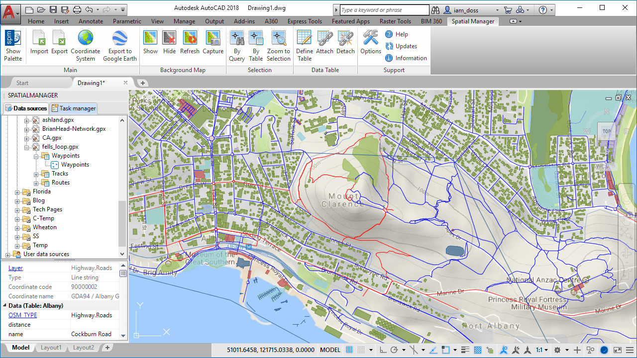
A drawing referenced to the recently included CRS “GDA94 / Albany Grid 1994 (ALB94)”
These Coordinate Systems were not in the latest EPSG 9.0 objects database included in the version 4.1 of ‘Spatial Manager’. To add them:
- We have updated EPSG to version 9.2. It includes the projections based on GDA2020 (Geocentric Datum of Australia 2020)
- These CRSs are identified by their EPSG code
- We have include in the application core the projections based on GDA94 (Geocentric Datum of Australia 1994) and AGD84 (Australian Geodetic Datum 84)
- In this group, the CRSs are identified by the codes 90000001 to 90000037
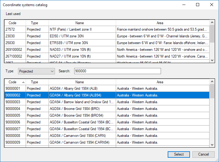
Western Australia CRSs in SPM Catalog
These enhancements will not be included in the application until the next release, but if you need it or you want to try them, please send us an mail (info@spatialmanager.com) specifying the version you are interested in (AutoCAD / BricsCAD / ZWCAD / Desktop), and we will send you the latest build of the application
If you want to learn more about the use of Coordinate Systems in ‘Spatial Manager’, please refer to to the following articles in the Technical Wiki of each product:
· Spatial Manager for AutoCAD
· Spatial Manager for BricsCAD
· Spatial Manager for ZWCAD
· Spatial Manager Desktop