‘Spatial Manager’ includes an option to manage the Z coordinate when importing spatial data (Shapefiles, Google Earth KML, ASCII, Excel, LiDAR, etc.) into AutoCAD, BricsCAD or ZWCAD drawings. It is a configuration little known by many of the application users and it may hide some features that need to be properly understood to optimize the results of the import process
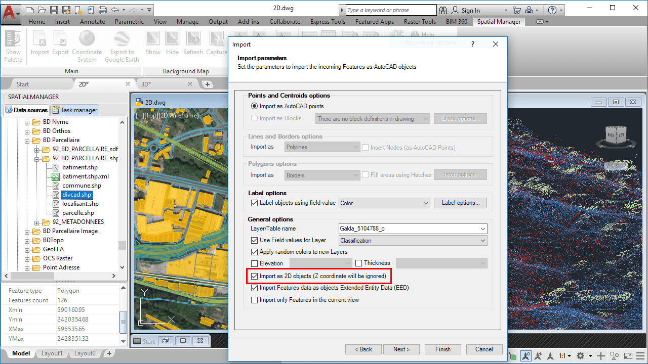
‘Spatial Manager’ – Import as 2D option
When the option “Import as 2D objects…” is checked in the application Import parameters, the Z coordinate of the elements being imported is ignored, and only the values of the XY coordinates are considered for the Points, Polylines, Polygons, etc. coming from the selected data source
In this way, you can get “flat” objects on the XY plane even when the imported source includes three-dimensional information, something that is very handy when working on 2D drawings. It is important to know that if you have configured the import process (in the same parameter window) to use the values in a field in order to define the objects Elevation, this XY plane will be placed in the Elevation corresponding to each object
It is also important to note that this option provides a set of preconfigured conditions depending on the type of data to be imported:
-
Data sources including necessary or relevant Z coordinate: The option is unchecked by default in order to import in 3D, but you can check it if only want to import the XY coordinates
- Some examples would be: LiDAR, PointZ type Shapefiles, ASCII files XYZ, PNEZD, PENZD, XYZDesc, UPT, or Custom with a field defining the Z-coordinate, etc.
-
Data sources that do not include information about the Z Coordinate: The option is checked and disabled (it is not possible to uncheck it) as only 2D information can be imported
- Some examples would be: MultiPoint, MultipointM, NullShape, Point, PointM, Polygon, PolygonM, Polyline or PolylineM Shapefiles, Raster files, ASCII files CodeXY, CodeYX, XYDesc, or Custom without afield defining the Z-coordinate, etc.
- Data sources in which it is a priori unknown whether or not they include Z-coordinate information: The option is checked by default in order to import in 2D, but you can uncheck it if you want to import Z-coordinates
To learn more about how to import spatial geometries and data into your CAD drawings, take a look at the following articles in the products technical Wikis:


