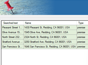
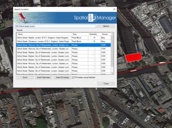
Le géocodage inverse est le processus permettant de récupérer des adresses postales et des informations associées à partir d’objets spatiaux dans un dessin.
Spatial Manager™ pour BricsCAD vous permet d’obtenir des données telles que les noms de rues, municipalités, codes postaux, etc., puis d’attacher automatiquement ces informations aux objets sélectionnés.
Cela améliore vos données spatiales en reliant les coordonnées géographiques aux détails d’adresses réelles directement dans BricsCAD.
Reverse geocoding is the process of converting geographic coordinates (latitude and longitude) into a human-readable address or place name. This is typically done using a reverse geocoding service or API,... more
Direct geocoding is the process of converting an address or a place name into geographic coordinates (latitude and longitude). This is typically done using a geocoding service or API, which... more
We are all increasingly familiar to locate places on a map using Google Maps or similar services, but what about being able to do it directly on our drawings or... more
Within this interesting example we show how to include, on an existing AutoCAD or BricsCAD drawing of a city, locations from a list of addresses as points (Blocks) on the drawing, using... more