Insertar leyenda en el dibujo en BricsCAD
Nueva en V10Inserta una leyenda de mapa temático directamente en el dibujo, facilitando la interpretación y comunicación del significado de los estilos aplicados. La leyenda refleja las categorías o rangos de valores usados en la presentación del mapa
Insertar leyenda en el dibujo
La leyenda se genera dinámicamente y muestra las categorías o rangos de valores aplicados, ayudando a los usuarios a interpretar visualmente los datos.
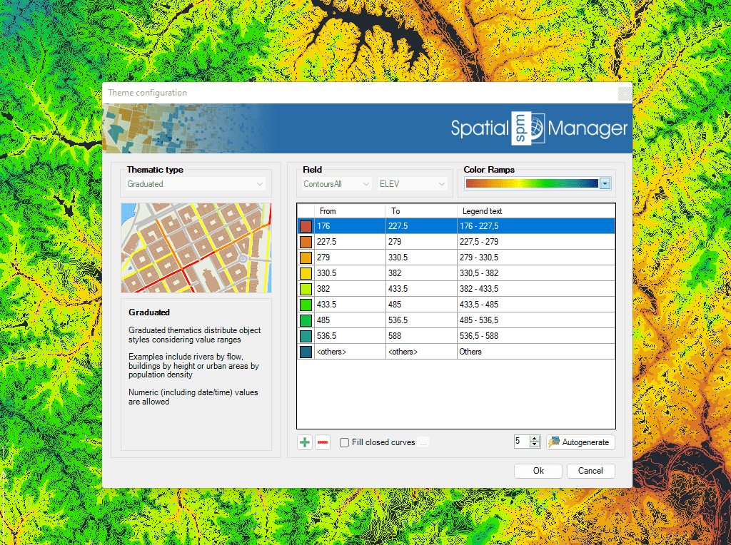
Los mapas temáticos se crean automáticamente en función de los valores de los campos. Utilice los valores fijos existentes o los rangos para establecer el tipo temático
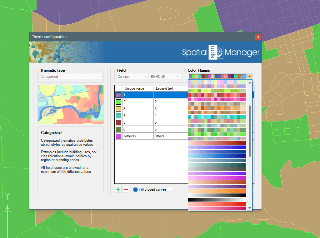
Cree su propio conjunto de reglas o seleccione un estilo predefinido. Los esquemas de color y las rampas de degradado más comunes ya están incorporados
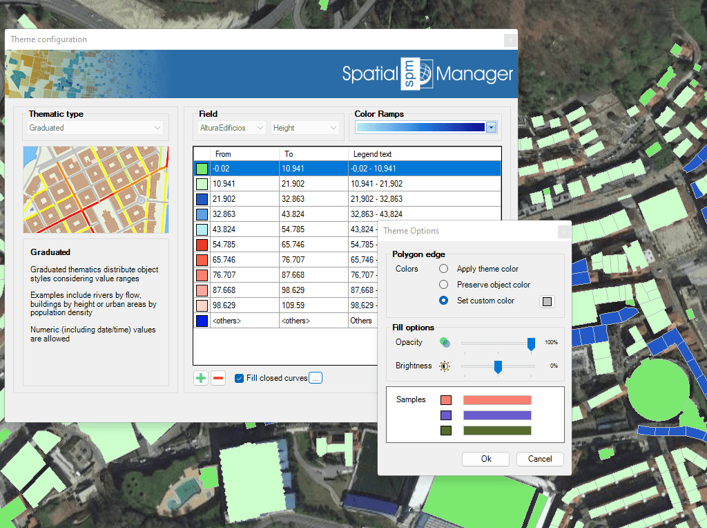
Para mejorar la visualización y la identificación de los objetos superpuestos, los objetos cerrados pueden rellenarse con sombreados
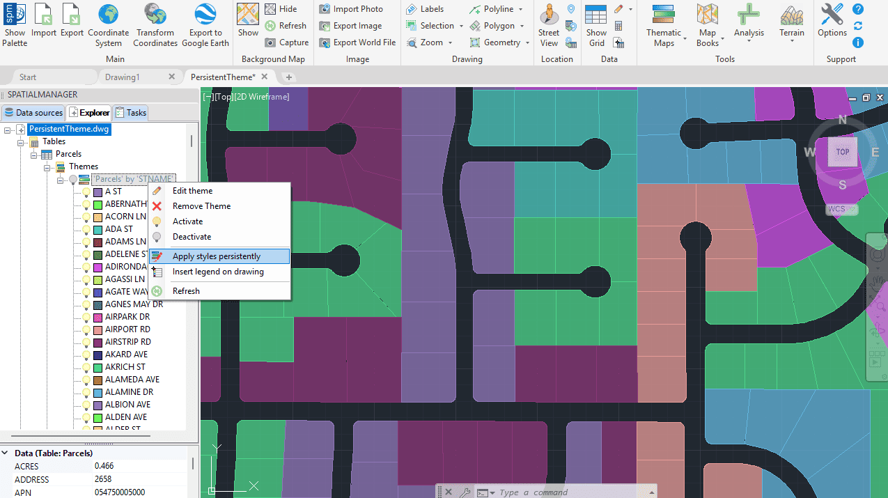
Mapas temáticos persistentes
Nueva en V10Una vez definido un mapa temático, puedes aplicar el estilo elegido de forma persistente en todo tu dibujo DWG.

Inserts a thematic map legend directly into the drawing, making it easier to interpret and communicate the meaning of the applied styles. The legend represents the categories or value ranges... more

Thematic Maps allow you to view objects colored by their data values, and you can also apply these styles persistently to the objects, causing these colors to override the DWG... more

Mapflow is a cutting-edge geospatial intelligence platform leveraging artificial intelligence to automatically identify and classify geographic objects–such as buildings, roads, and forested areas–within satellite and aerial imagery. Mapflow enables high-precision... more

Visualize objects by coloring them based on their field values. Different thematic styles can be applied, using either fixed field values (categorized) or value ranges (graduated). Choose from predefined color... more