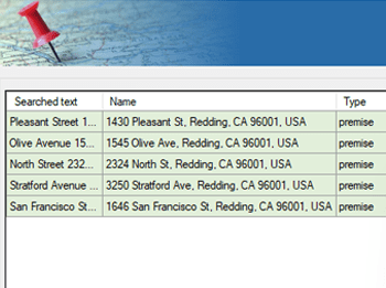
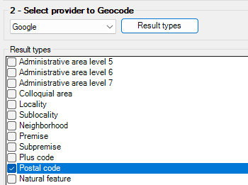
Spatial Manager™ para BricsCAD ofrece una herramienta intuitiva de búsqueda de ubicación que te permite encontrar direcciones, calles, barrios o elementos geográficos rápida y precisamente dentro de tu dibujo.
Simplemente introduce un nombre de lugar o dirección en la ventana de búsqueda, y el software hace zoom automáticamente a la ubicación o inserta su geometría o cuadro delimitador en tu proyecto.
Reverse geocoding is the process of converting geographic coordinates (latitude and longitude) into a human-readable address or place name. This is typically done using a reverse geocoding service or API,... more
Direct geocoding is the process of converting an address or a place name into geographic coordinates (latitude and longitude). This is typically done using a geocoding service or API, which... more
We are all increasingly familiar to locate places on a map using Google Maps or similar services, but what about being able to do it directly on our drawings or... more
Within this interesting example we show how to include, on an existing AutoCAD or BricsCAD drawing of a city, locations from a list of addresses as points (Blocks) on the drawing, using... more