Polygonen-Zentroide in ZWCAD
Ermöglicht die Erzeugung von Polygonschwerpunkten (Punktobjekten) durch Übernahme der Polygondaten oder das Hinzufügen von Schwerpunktdaten zu den Polygonen, die sie enthalten
Polygonen-Zentroide
- Zentroiden generieren: Erstellen Sie Zentroidpunkte für ausgewählte Polygone und hängen Sie automatisch die Attributdaten der Polygone an die neuen Zentroidobjekte an.
- Zentroiddaten erfassen: Übertragen Sie Daten von ausgewählten Zentroidpunkten zurück auf Kopien der Polygone, die sie enthalten. Dies ermöglicht die Anreicherung der Polygonattribute mit Informationen, die von ihren Zentroiden abgeleitet sind.
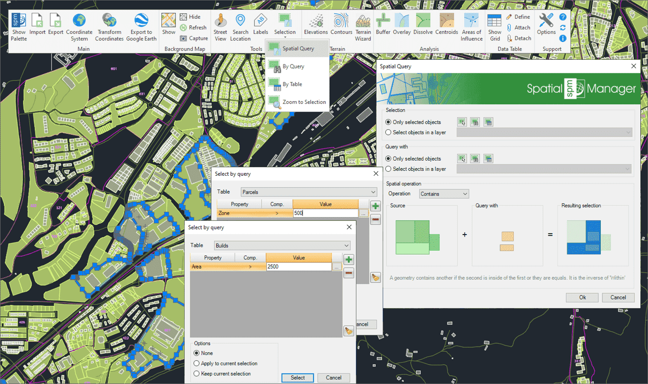
Wählen Sie Objekte in der Zeichnung entsprechend dem Ergebnis von erweiterten einfachen oder zusammengesetzten räumlichen Abfragen durch die folgenden geometrischen Operationen aus.
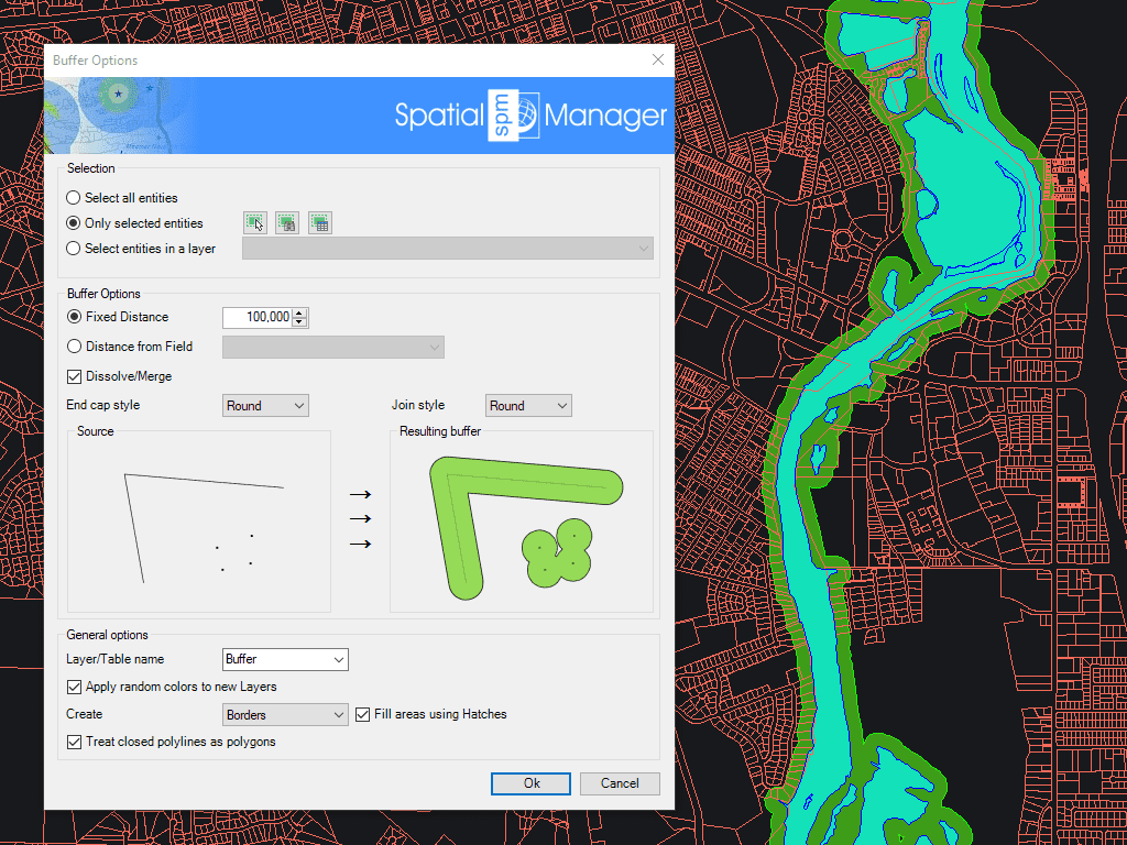
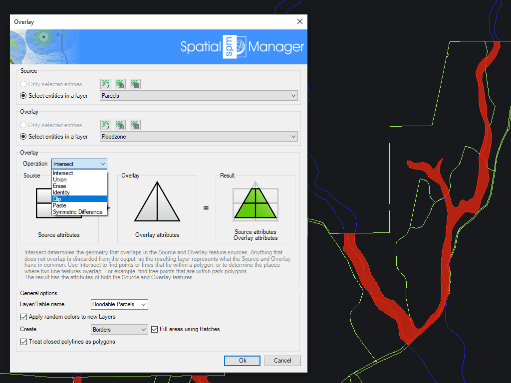
Ermöglicht das Erstellen neuer Features auf Basis von geometrischen und Datenoperationen zwischen zwei bestehenden Feature-Gruppen. Diese Operationen sind: Überschneidung, Vereinigung, Löschen, Identität, Schnitt, Einfügen und Symmetrische Unterschied.
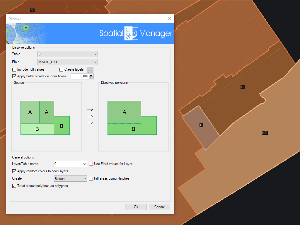
Erzeugen neuer Polygone basierend auf der Gruppierung anderer benachbarter Polygone mit einigen gemeinsamen Daten
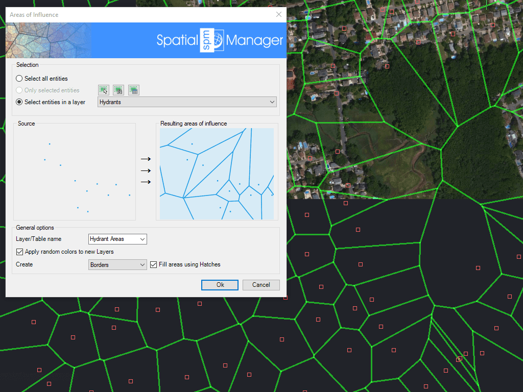
Erzeugt Polygone, die durch die Punktmengen definiert sind, die jedem Punkt einer Auswahl in der Karte am nächsten liegen (Voronoi-Diagramme)

Mapflow is a cutting-edge geospatial intelligence platform leveraging artificial intelligence to automatically identify and classify geographic objects–such as buildings, roads, and forested areas–within satellite and aerial imagery. Mapflow enables high-precision... more

In this third example on spatial analysis using Overlays in ‘Spatial Manager’ we will apply the “Intersect” operator. This operator determines the geometries that overlap in the Source and Overlay... more

In this second post dealing with Overlays in ‘Spatial Manager’, we will analyze another interesting operator (Clip), which creates objects from the areas of the Source that overlap with the... more

This post starts a series dedicated to one of the most powerful geometric and data-driven analysis tools included in ‘Spatial Manager’: the Overlay command. There are several operators to apply... more