The Export functionality in ‘Spatial Manager’ is one of the most advanced application tools that allows you to write in geo-spatial data containers (files like Shapefiles, KML, GML, etc., or databases like PostGIS or SQL Server) objects of your map or drawing
Related videos: AutoCAD / BricsCAD / ZWCAD
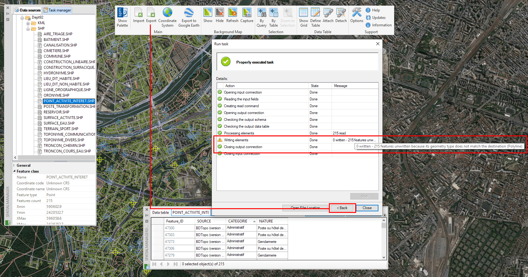
“Back” button to review any Export parameters and replay the process
The Export wizards include a large number of potential parameters to fully customize the elements to be exported, their added data, coordinate transformations, and so on
In many scenarios the final result of an export process is not the desired one, either because some parameters have not been defined correctly or because the user has omitted some steps in the Export Wizard without realizing that this could lead to erroneous results
Since repeating an export process involves re-entering all the parameters in the wizard, now the CAD versions of ‘Spatial Manager’ include a ‘Back’ button at the end of the process, which will allow you to replay it again without having to modify or re-enter all the parameters but only those you decide to modify
In the above videos you can review a typical export experience in which this situation can happen and you can check the benefits of this new ‘Back’ button to quickly modify parameters in the wizard and easily relaunch the process
Learn more about Exporting objects to geo spatial targets in ‘Spatial Manager’:
You can find more info about ‘Spatial Manager’ Exporting tools through these Blog posts
Note: CAD versions full Export functionality is available in the Professional edition only


