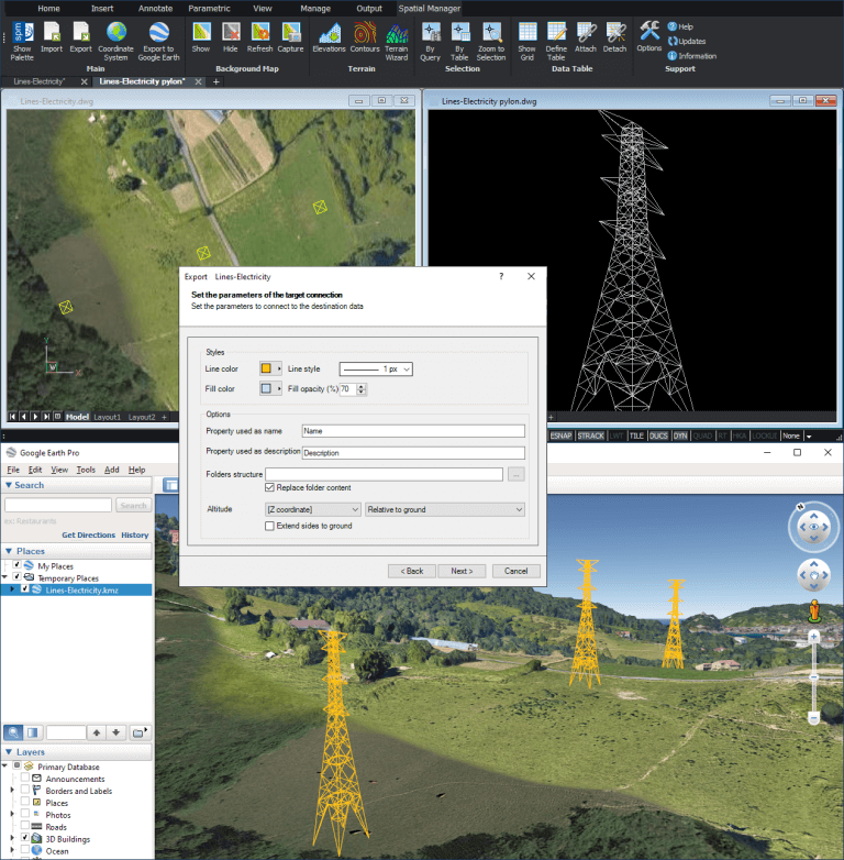
Although you can find several examples in this Blog where you can see how to export 3D objects to Google Earth basing their altitudes on an attached data or on their constant Z elevation, you can also export native 3D objects (such as Polylines or Lines in CAD versions). The case study reviewed in this Blog entry illustrates a very common scenario
Related videos: AutoCAD / BricsCAD / ZWCAD
In the above related videos, you can learn how to export to Google Earth 3D objects built in CAD using 3D Lines (in this case a set of electric high voltage towers)
As you can see in the following image, the KML/KMZ ‘Spatial Manager’ data provider parameters will allow you, not only to define graphic styles for the resulting elements, but also to choose the main Google Earth properties for these elements and to select from which data to take the altitude values and how to consider them (Relative to ground, Clamped to ground, Absolute, etc.)
In this way, you can review your 3D CAD objects located at their actual places and altitudes on Google Earth
Enjoy the videos
Learn more about Export functions in the ‘Spatial Manager’ technical Wiki:
Note: Full Export functionality is available in the Professional Edition only

