Text Labels help to complete the CAD or GIS drawings and maps and enrich the complementary information contained therein, as they not only allow better understanding but also make it easier to locate the objects. Spatial Manager™ (AutoCAD and BricsCAD) now includes the objects labeling functionality
Videos: AutoCAD / BricsCAD
Spatial Manager (AutoCAD or BricsCAD) lets you select the option “Label Points or Centroids using field value” while importing from a spatial data source. This option allows you to select any Field to create Texts in AutoCAD or BricsCAD in order to Label the incoming Points or polygon Centroids by reading the text strings from this Field
If you select this option and the source data includes polygons, the Centroids options are automatically selected. If you have chosen the “Borders” option for polygons, it will be automatically changed to “Borders and Centroids”. The same applies between the “Polygons” and the “Polygons and Centroids” options
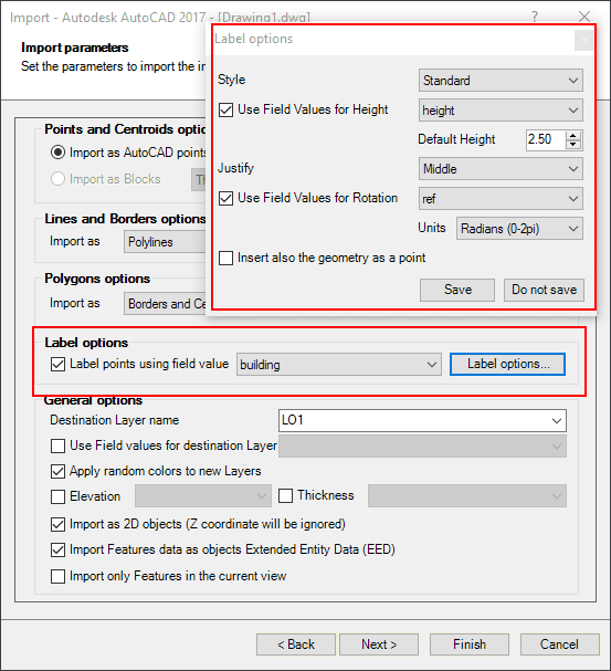
You can define the Style, Height, Justification, Rotation and Rotation Units of the Text objects. Some of these parameters can be taken from Fields in the data source. As an added parameter, you can configure if you also want to insert the geometry as a Point (or Block) object in AutoCAD or BricsCAD


