The new version 3.1 of Spatial Manager™ has been already released. It comes full of interesting innovations and all the users will enjoy the best Spatial Manager™ applications suite published so far. Try it or update your applications

Goal#1. Powerful and Easy to use Background Maps
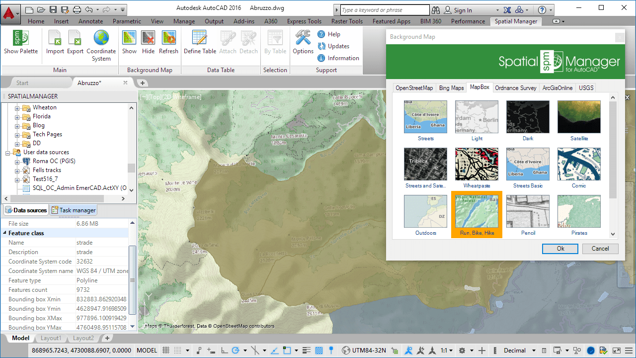
If you are an AutoCAD (v.2008 – v.2017) or BricsCAD (v.13 – v.16) user, you can now choose from among many Backgrounds Maps from many providers such as OpenStreetMap, Bing, MapBox, etc. They will enhance the drawings quality and will let you compare and check better
Video#1: AutoCAD * BricsCAD
Learn more: AutoCAD * BricsCAD
Goal#2. Data Structure Management and Direct Data Edition
Design and edit the Structure which will be used to store the data attached to the objects. Manage the Tables and the Fields according to your needs. You will also find new Tools available to Attach, Detach and Select data. The data attached to the objects (EEDs/XDATA) is no longer read-only data
Video#2: AutoCAD * BricsCAD
Learn more: AutoCAD * BricsCAD
Goal#3. Labeling objects while importing
You can now Label the Point features or the Centroids while importing from files or spatial tables into the drawing. Text label properties taken from fields
Video#3: AutoCAD * BricsCAD
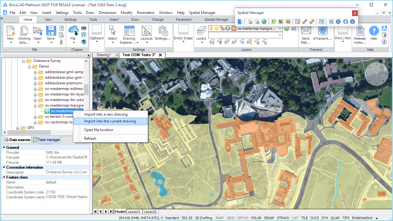
Goal#4. New GML data provider. UK Ordnance Survey data compatibility
The GML data provider has been added to the extensive list of the Spatial Manager™ data providers. You can now read GML, GZ and XML files. Good news for the UK users who can now Access the great Ordnance Survey MasterMap spatial data information
Video#4: AutoCAD * BricsCAD
And…
Importing news
Spatial filter to import only the objects in the current view (2)
Elevation parameter applied to all objects (Points, Blocks, etc.) (2)
New rotation units in the Block parameters (2)
Non-numeric fields are now valid Parameters for Blocks, Elevations or Thickness (2)
OpenStreetMap lets you now choose the fields to read
SQL Server parameter to select the syntax for new date fields
WFS spatial boundaries when importing
New ‘Create shortcut from path’ allows you define Shortcuts for network addresses
Random colors for new Layers have been enhanced
New image formats for user symbols (PNG, JPG, GIF, BMP) (1)
Exporting news
New optional items (2):
– Handle of the objects
– Layer of the objects
– Elevation of the objects
– Attributes of the Block references
– Text objects and their basic properties (Rotation and Height)
Z coordinates are now exported in all cases (2)
– The Elevation can be taken as Z coordinate if it is not available
Coordinate Systems news
‘Last-used’ CRS list also available when assigning CRSs to drawings (2)
Multiple search terms are now applied in any field (not all in the same field)
The search filter used previously remains unchanged in the catalog along a working sesion
Optimized the workflow when showing a background map without a Coordinate System assigned to the drawing (2)
– In addition to a relevant warning, the Coordinate System catalog is directly accesible
The “Geolocation” Tab in the AutoCAD Ribbon can be optionally configured to prevent its automatic activation (3)
EPSG 8.9 update (CRSs and other objects)
Performance and compatibility news
Drawing the objects once imported is almost instantaneous (2)
Remarkable speed-up when reading geometries
Centroids calculation methods improved
Exporting to KML or KMZ files performance has been significantly improved
Application loading times reduced
Trial version less restrictive: 75% of the objects are processed anyway
AutoCAD 2017 compatibility (and many other Autodesk 2017 products) (3)
BricsCAD 16 compatibility (4)
Windows 10 compatible
(1) Desktop only
(2) AutoCAD and BricsCAD only
(3) AutoCAD only
(4) BricsCAD only
Note: some functions are available on the “Standard” and/or “Professional” editions only


