SPM for GstarCAD > Features > Background maps > Snapshots

Snapshots in GstarCAD

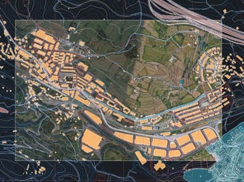
Capture static background map images and insert them into the drawing as raster images (PNG, JPG, TIF) or OLE objects. Snapshots can be georeferenced using a World File, and you can select the image detail level. Ideal for presentations, printing, or external GIS use.

Editions: Standard Professional
What's included in the feature Snapshots

Discover the full potential of this set of tools designed to enhance GIS data integration and editing within GstarCAD.

Snapshots

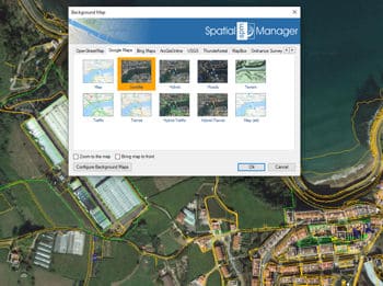
Get static GstarCAD raster images from the Maps. Up to four levels of image resolution. Provides interesting solutions to define different maps for different Viewports and/or Views, as an advanced Printing or Publishing tool, to combine Maps or to clip the Maps.


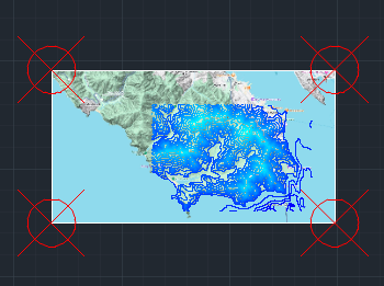
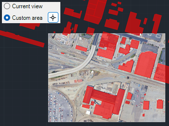
Capture view or custom area

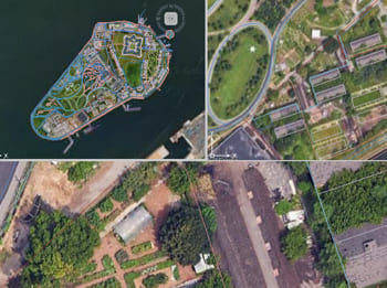
Capture background map snapshots from the current view or by digitizing a custom area.


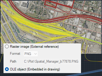
Insert as raster or OLE

Snapshots can be inserted as raster images and referenced in different formats (PNG, JPG, or TIF), or as OLE images embedded directly in the DWG file.


Georeferenced Snapshots

Snapshots created as raster images are stored next to the drawing and are accompanied by a World File. This file makes it possible to use the raster image directly in other GIS software.


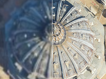
Detail level

Image detail level can be selected. By default, optimal quality is used, which matches the quality of the current view. For performance reasons and to reduce file size, the highest image quality is achieved when the captured area is smaller. Therefore, if maximum quality is required, it is recommended to make multiple captures of smaller areas.
frequently asked questions
Current compatible GstarCAD applications:
  • Versions: From v.2018 to v.2026 both included. Review the version compatibility page for more details.
  • Editions: Standard, Professional and Educational
System requirements:
  • Windows 7 or higher, within the operating system versions supported by the GstarCAD version used
  • 500 MB free disk space, or more
  • Windows Installer 3.1 or later
Spatial files
  • Esri Shape file - (SHP)
  • Google Earth file - (KML, KMZ)
  • OpenStreetMap file - (OSM, PBF, OSC) (1)
  • LiDAR file - (LAS, LAZ)
  • GPS exchange format file - (GPX)
  • Esri ASCII Grid file - (ASC, ASCII) (1)
  • ASCII text file - (ASC, CSV, NEZ, TXT, XYZ, UPT)
  • SQLite file - (SQLITE, DB)
  • GeoPackage file - (GPKG)
  • GML file - (GML, GZ, XML)
  • Raster image file - (TIF, PNG, JPG, JPEG, TIFF) (1)
  • Autodesk SDF file - (SDF) (3)
  • MicroStation v.7 file - (DGN) (2)
  • AutoCAD DXF file - (DXF) (2)
  • Esri ArcInfo export file (ASCII) - (E00) (1) (2)
  • MapInfo file - (TAB) (2)
  • MapInfo interchange format file - (MIF/MID) (2)
  • GeoJSON file - (GEO.JSON)

Spatial raster files
  • Raster image file - (TIF, PNG, JPG, JPEG, TIFF) (1)
    • Georeference sources - (World files, Google Earth .GEPRINT, etc.)
  • Variable resolution Raster image file - (Cloud Optimized GeoTIFF/COG TIFF) (1) (4)

Spatial data servers and Geo-databases
  • Esri Geodatabase File - (GDB) (1)
  • PostGIS database
  • Microsoft SQL Server Spatial database
  • MySQL database (1) (3)

Image map servers
  • WMS/OGC API Maps Web Map Services (4)
  • WMTS/OGC API Tiles Web Map Tile Services (4)
  • XYZ/TMS Tile Map Services (4)

Other spatial data sources
  • Open Database Connectivity ODBC (1)
  • WFS/OGC API Features data store (1)
  • WFS data store (FDO) (1) (3) (5)
  • WFS data store (OGR) (1) (2) (5)

(1) Read-only
(2) OGR data source
(3) FDO provider (May not be available on GstarCAD 32-bit)
(4) Background Maps technology
(5) DEPRECATED - Whenever possible use the native WFS/OGC API Features data provider

Note: certain data Providers are only valid for some Editions of the application