Spatial Manager Desktop™ provides a comprehensive set of tools to perform spatial analysis operations over the vector objects of the drawing or map and their attached data, resulting in new objects generated by the resolution of such operations
Spatial analysis operations can be performed on a combination of tables, layers or drawing objects previously selected by interacting with on-screen elements or by using the application's advanced selection queries
Overlay
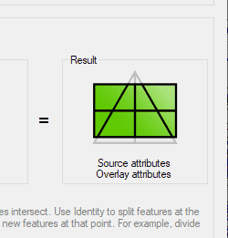
Allows you to create new features based on geometric and data operations between two existing feature groups. These operations are':' Intersect, Union, Erase, Identity, Clip, Paste and Symmetric Difference
Dissolve
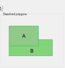
Generate new Polygons based on the grouping of other adjacent polygons with some common data
Polygon centroids
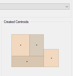
Allows you to generate Centroids (Point features) for the selected polygons. The polygons data will be attached also to the Centroid features
In this third example on spatial analysis using Overlays in ‘Spatial Manager’ we will apply the “Intersect” operator. This operator determines the geometries that overlap in the Source and Overlay... more
In this second post dealing with Overlays in ‘Spatial Manager’, we will analyze another interesting operator (Clip), which creates objects from the areas of the Source that overlap with the... more
This post starts a series dedicated to one of the most powerful geometric and data-driven analysis tools included in ‘Spatial Manager’: the Overlay command. There are several operators to apply... more
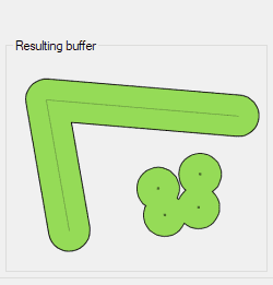
Among the spatial analysis tools included in ‘Spatial Manager’, the Buffer function allows you to generate Buffered polygons around point, linear (lines, polylines, etc.) or polygonal (boundaries) objects. Buffers have... more