Save modified layers or new layers
Any external layer can be saved to replace its original source data table. Internal layers, such as new or disconnected layers, can be exported to a table in any spatial file, database server or spatial connection
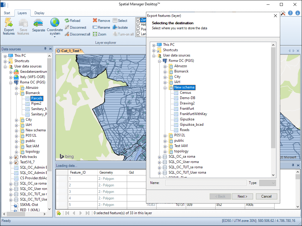
Save modified layers or new layers
New or internal layers—such as those created or disconnected from external sources—can be exported to spatial files, database servers, or other spatial connections for seamless data management and sharing.
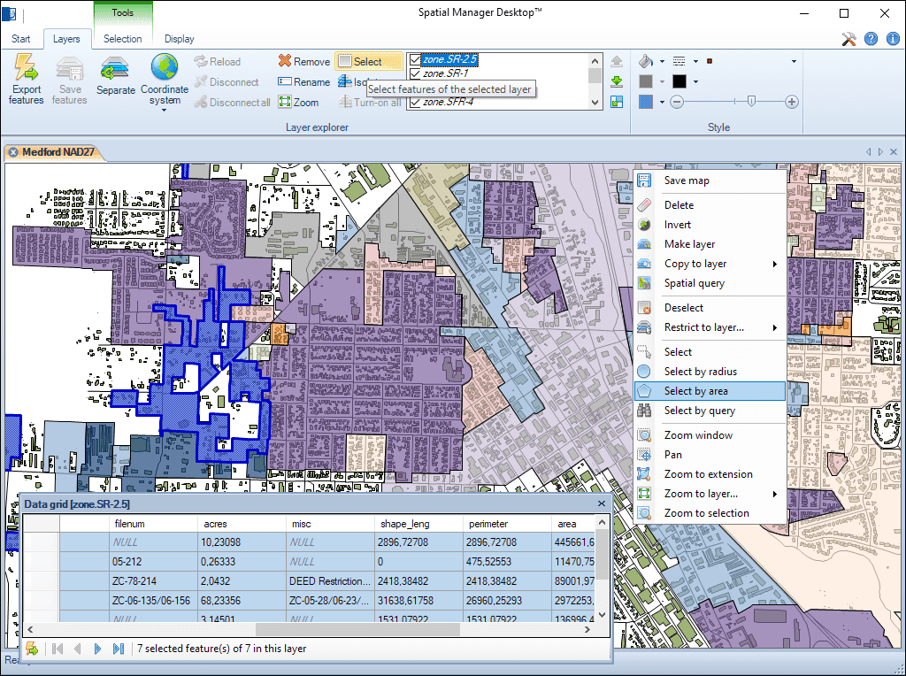
Multiple graphical selection methods and layer selection. Add or remove features to the selections by using multiple methods. Quickly filter selections by layer
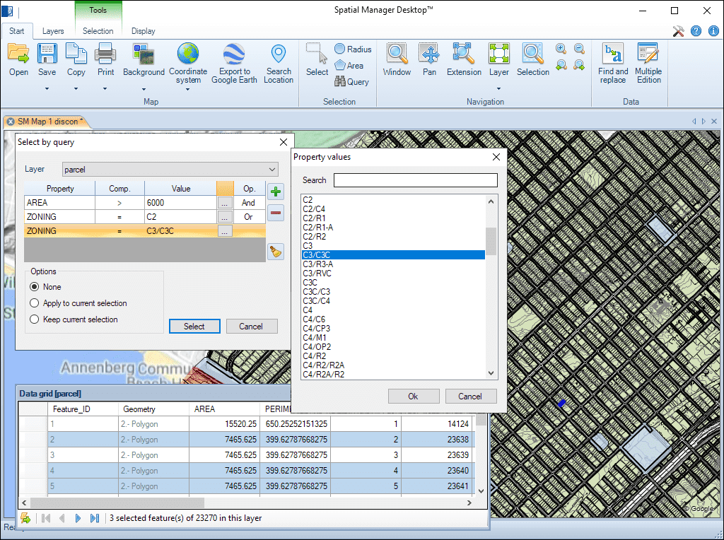
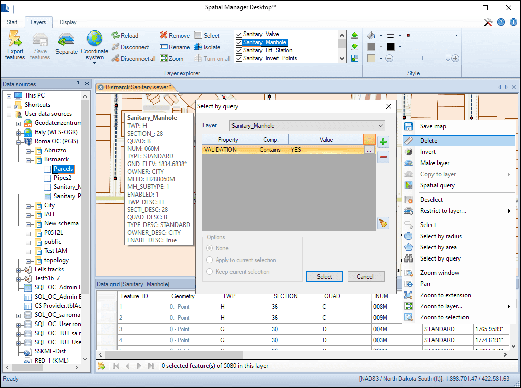
Single or complex selections by query. Data grid selections. Data grid navigation tools through the selections. Advanced information for the selections in the data grid
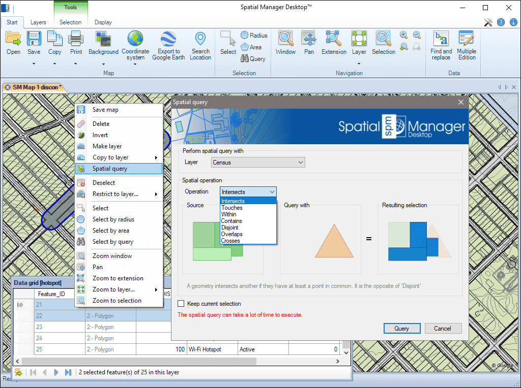
Query selections by performing geometric operations to locate features that interfere with other features under certain conditions (intersects, touches, within, contains, disjoint, overlaps or crosses)
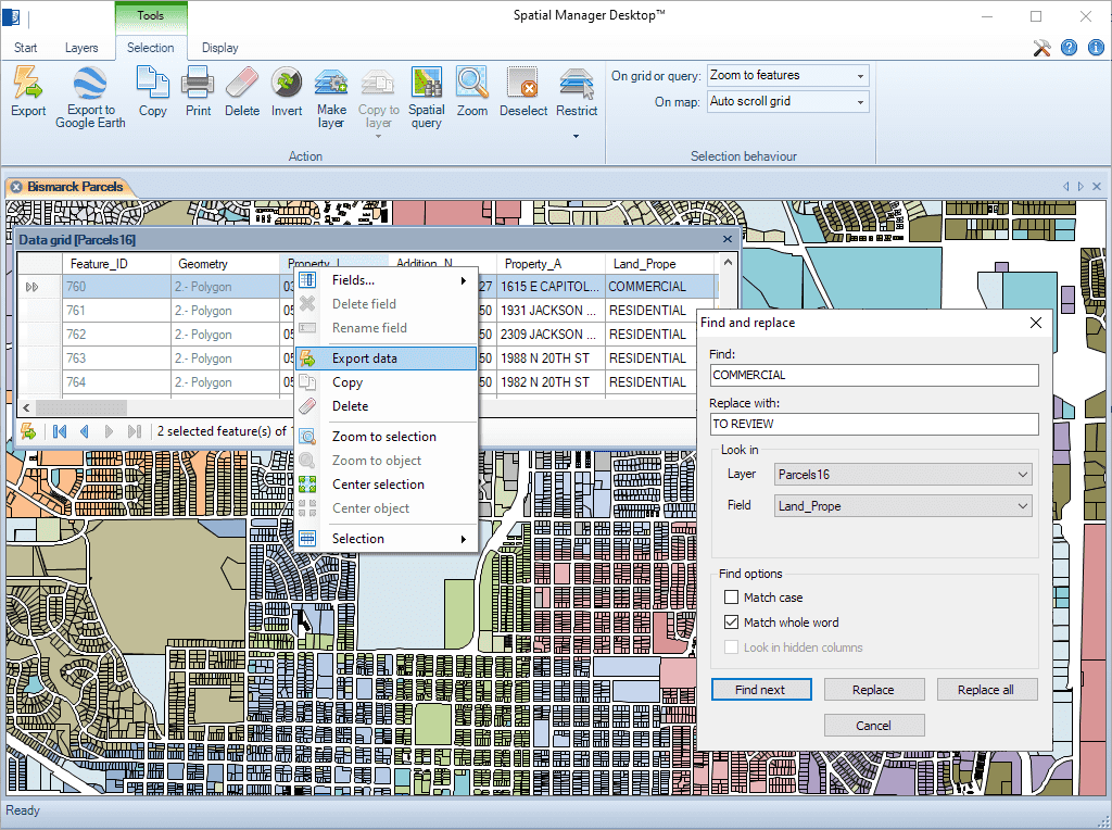
Find (and replace) data in the data grid applied to the values of fields in layers. "Replace all" functionality included. Reports including the modified values and fields
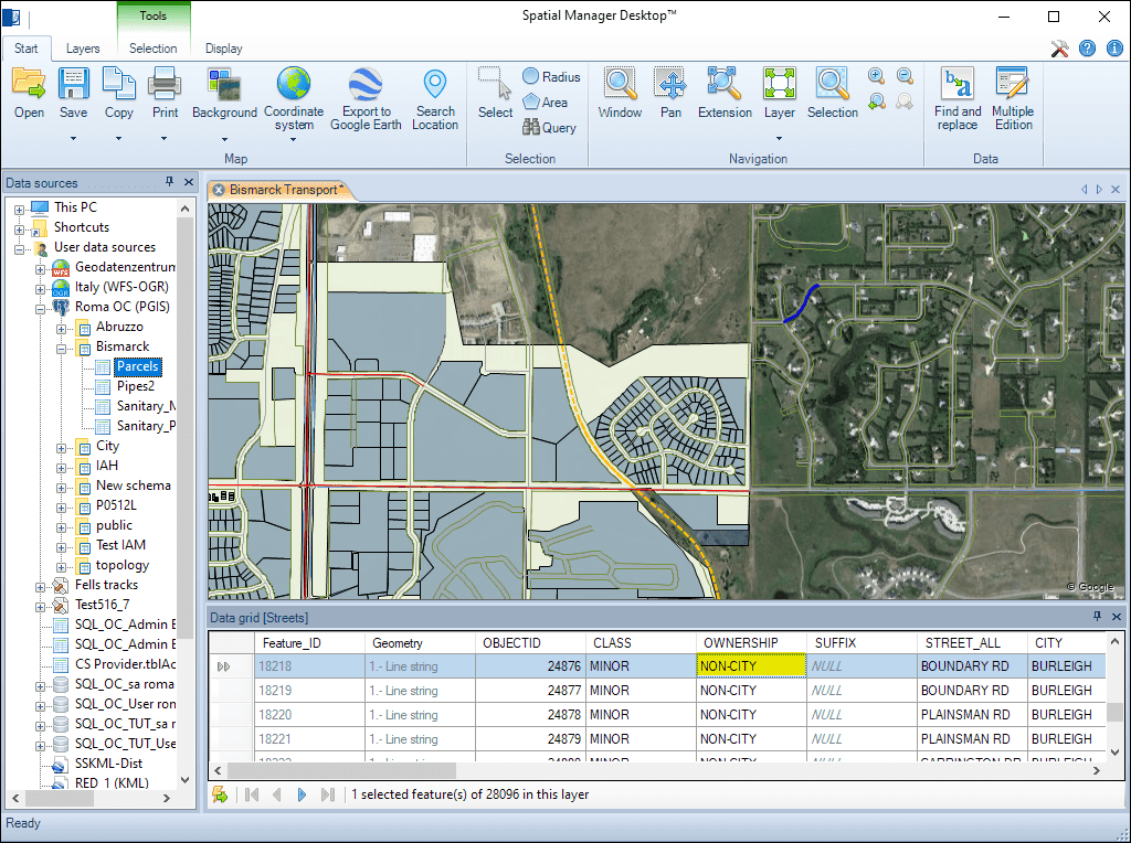
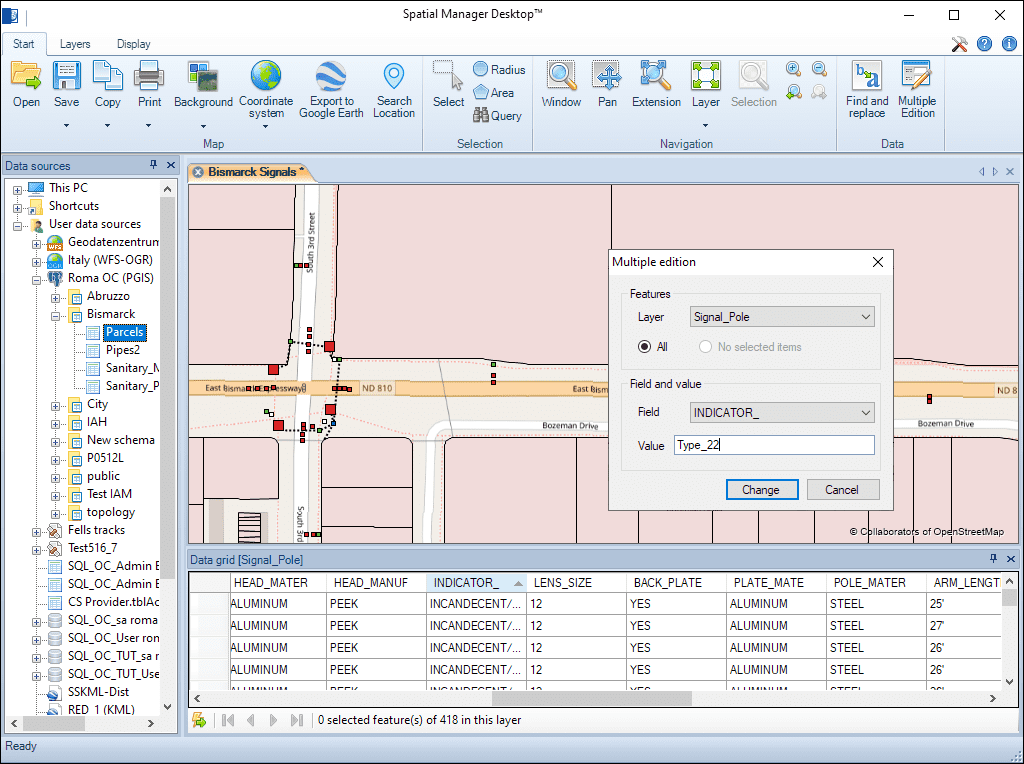
Edit the value of any layer field in the data grid for more than one feature simultaneously

Reverse geocoding is the process of converting geographic coordinates (latitude and longitude) into a human-readable address or place name. This is typically done using a reverse geocoding service or API,... more

GML (Geography Markup Language) is an XML-based language created by the Open Geospatial Consortium (OGC) for modeling, transporting, and storing geographic information. GML files classify elements by type, and Spatial... more

Perform calculations on new or existing field values by applying a wide range of operators and functions, such as arithmetic operations (addition, subtraction, multiplication, division), mathematical functions (square root, logarithms,... more

Direct geocoding is the process of converting an address or a place name into geographic coordinates (latitude and longitude). This is typically done using a geocoding service or API which... more