Sistemas inteligentes para a abertura de mapas
Tecnologia de busca inteligente que facilita a localização de origens modificados (deslocados, renomeados, etc.) de camadas externas ao carregar um mapa
Sistemas inteligentes para a abertura de mapas
Isso garante um carregamento mais suave do mapa, mesmo quando os arquivos de origem mudaram de local ou nome.
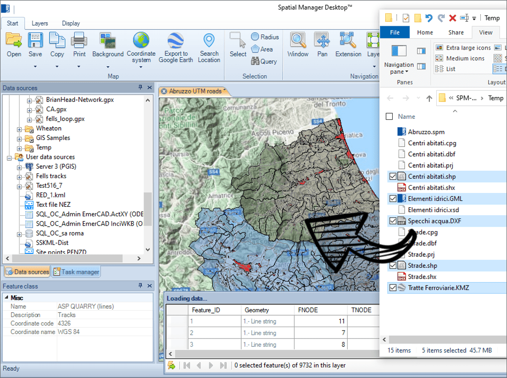
Carregar as tabelas de dados dos arquivos espaciais nos mapas, arrastando e soltando-as desde o Windows explorer. Esta forma de carregamento permite carregar vários arquivos ao mesmo tempo. Abra os arquivos em novos mapas, clicando duas vezes sobre eles no Windows explorer
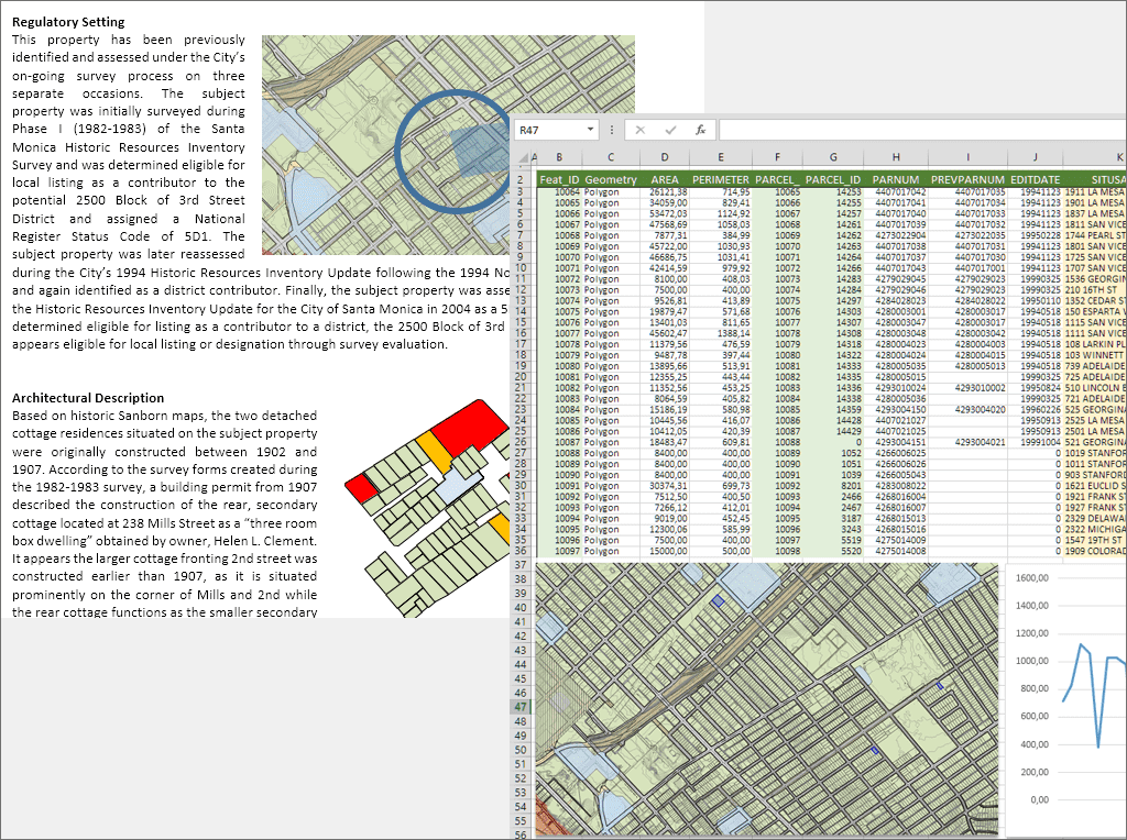
Exportação avançada de dados em camadas, seleções, etc. desde a grade de dados. Cópia raster ou vetorial na área de transferência do Windows de todo o mapa, elementos selecionados ou elementos incluídos em uma vista
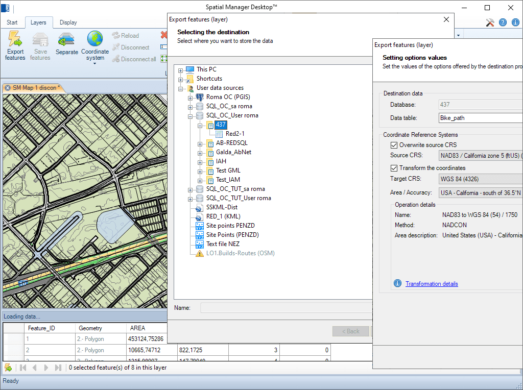
Tabelas completas, camadas ou seleções de elementos podem ser importadas ou exportadas de/para qualquer recipiente de dados espaciais. O assistente de importação/exportação guia o usuário através dos processos de seleção da origem e destino e seus parâmetros de conexão, os parâmetros de transformação de coordenadas, etc.
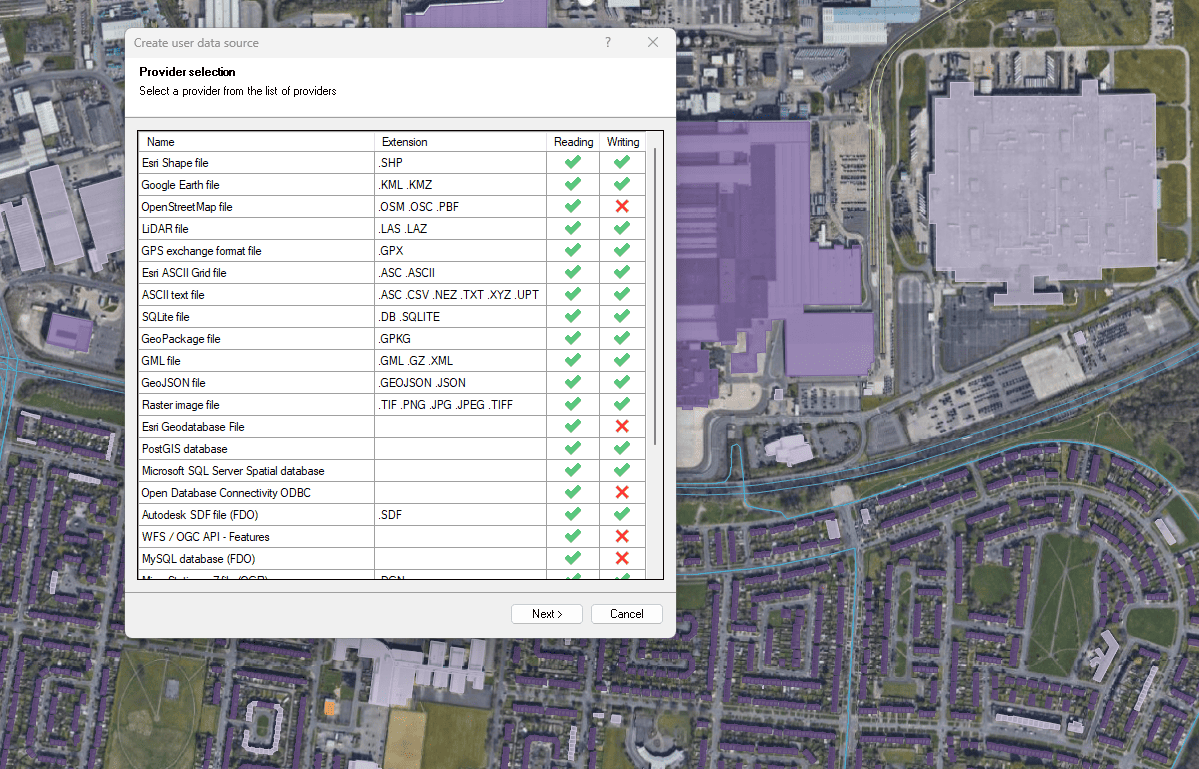
Arquivos, bancos de dados e serviços online
Melhorada em V10Conecte-se a uma ampla variedade de fontes de dados espaciais

Access and import authoritative LINZ (Land Information New Zealand) vector datasets directly into your DWG through the LINZ WFS (Web Feature Service). Spatial Manager connects to the WFS endpoint and... more

Download and import official Land Information New Zealand (LINZ) data into a DWG using Spatial Manager, either through open services (WFS / OGC API Features) or distributed files (SHP, GeoJSON,... more

View detailed, high-resolution LINZ background maps directly in your DWG through WMTS services–no prior tile download required. Spatial Manager connects to the LINZ WMTS endpoint, requests only the tiles needed... more

OGC API Features is a modern, RESTful standard developed by the Open Geospatial Consortium (OGC) for accessing and managing geospatial feature data over the web. It is the evolution of... more