Centroides de polígonos en ZWCAD
Permite generar Centroides de polígonos (objetos tipo Punto) adoptando los datos de los polígonos, o añadir datos de Centroides a los polígonos que los contienen
Centroides de polígonos
- Generar centroides: Crear puntos centroides para los polígonos seleccionados, adjuntando automáticamente los datos de atributos de los polígonos a los nuevos objetos centroides.
- Capturar datos de centroides: Transferir datos de los puntos centroides seleccionados a copias de los polígonos que los contienen. Esto permite enriquecer los atributos de los polígonos con información derivada de sus centroides.
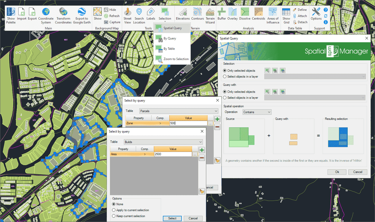
Selección de objetos en el dibujo según el resultado de consultas espaciales avanzada simples o compuestas mediante las siguientes operaciones geométricas.
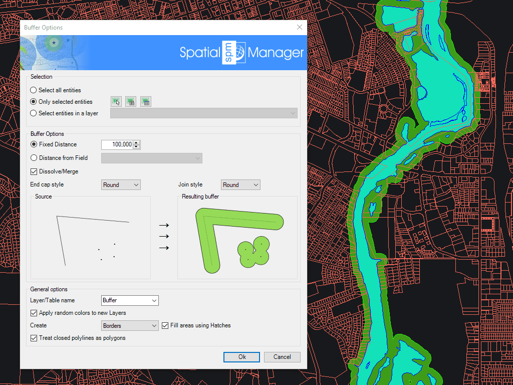
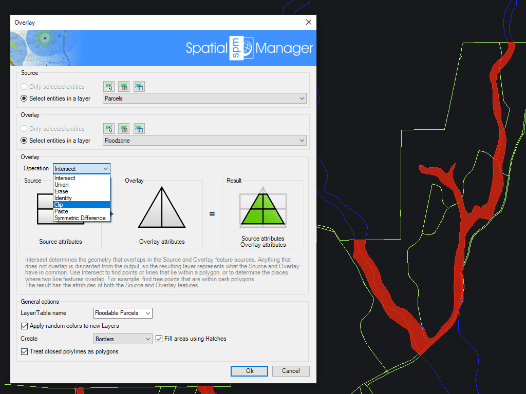
Permite crear nuevos objetos basados en operaciones geométricas y de datos entre dos grupos de objetos existentes. Estas operaciones son: Intersección, Unión, Borrar, Identidad, Delimitar, Pegar y Diferencia Simétrica.
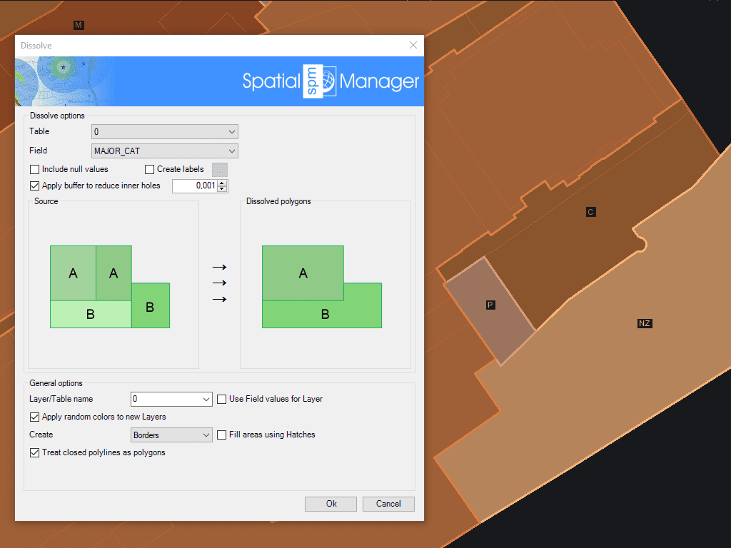
Genera nuevos polígonos basados en la agrupación de otros polígonos adyacentes con algunos datos comunes
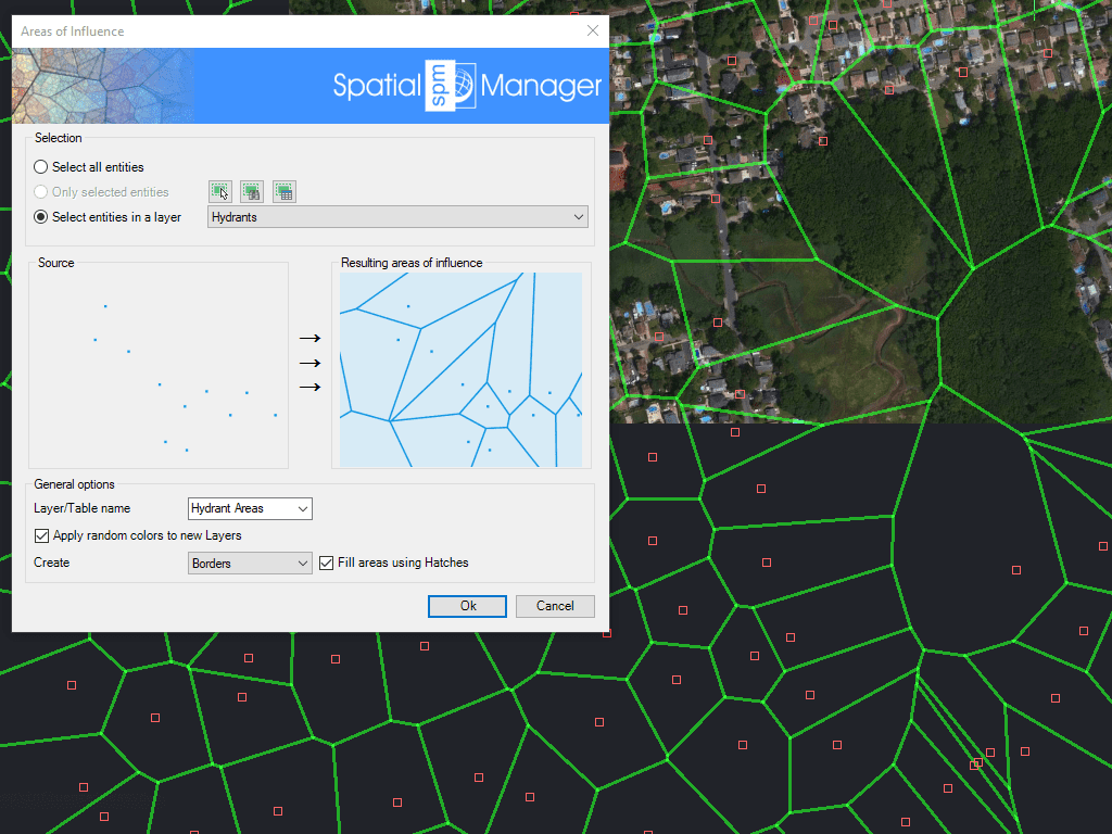
Crea polígonos definidos por los conjuntos de puntos más cercanos a cada punto de una selección en el dibujo (diagramas de Voronoi)

Mapflow is a cutting-edge geospatial intelligence platform leveraging artificial intelligence to automatically identify and classify geographic objects–such as buildings, roads, and forested areas–within satellite and aerial imagery. Mapflow enables high-precision... more

In this third example on spatial analysis using Overlays in ‘Spatial Manager’ we will apply the “Intersect” operator. This operator determines the geometries that overlap in the Source and Overlay... more

In this second post dealing with Overlays in ‘Spatial Manager’, we will analyze another interesting operator (Clip), which creates objects from the areas of the Source that overlap with the... more

This post starts a series dedicated to one of the most powerful geometric and data-driven analysis tools included in ‘Spatial Manager’: the Overlay command. There are several operators to apply... more