Consultas de datos en BricsCAD
Utiliza consultas para seleccionar objetos del dibujo basándote en condiciones de atributos
Descubre todo el potencial de este conjunto de herramientas diseñado para mejorar la integración y edición de datos GIS dentro de BricsCAD.
Consultas de datos

Seleccionar por tabla

Gestión de la estructura de datos
Selección de objetos mediante Consultas simples o compuestas
Localización de polígonos atravesados por objetos lineales específicos
Cómo utilizar el valor por defecto de los campos
Nueva rejilla de datos
Crear una tabla de dibujo a partir de la rejilla de datos
Calculadora de campos

Tabla de datos
Mejorada en V10Las tablas de datos proporcionan la estructura para asociar información con objetos del dibujo. Pueden adjuntarse automáticamente durante la importación o crearse manualmente añadiendo campos de diversos tipos de datos.
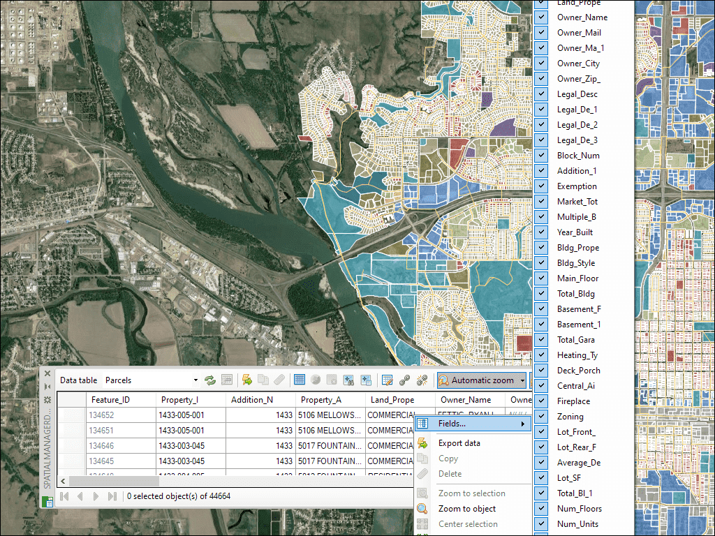
La paleta de la Rejilla de Datos en BricsCAD le permite ver, editar, etc. los datos de los objetos para cualquier tabla del dibujo. También puede seleccionar objetos desde la Rejilla de Datos, exportar los datos de las tablas, etc.
* Disponible únicamente en la edición Professional
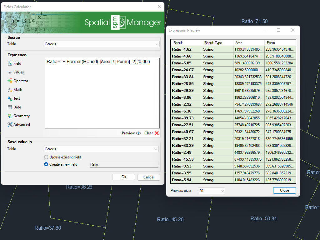
Calcule en BricsCAD expresiones simples o complejas utilizando operadores y funciones que pueden aplicarse a los valores de los campos de una tabla y/o a valores constantes
* Disponible únicamente en la edición Professional
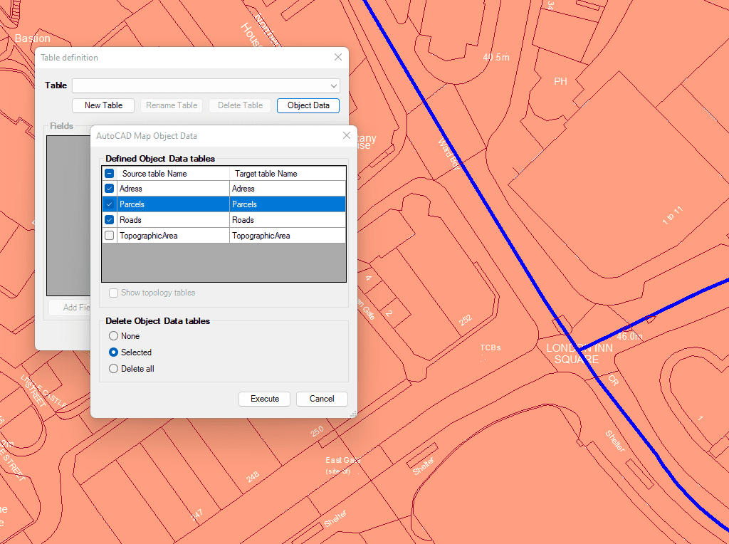
Importe y convierta los datos desde el formato de AutoCAD Map a Datos Extendidos (EDD) de BricsCAD.

Integración con sus propias funciones LISP mediante la API (Interfaz de Programación de Aplicaciones) para crear operaciones personalizadas relacionadas con los datos
* Disponible únicamente en la edición Professional

Generates a CAD table directly in the drawing using the data linked to the objects. Users can define which fields will appear as columns, making the table highly customizable. In... more

Multiple tables with various fields can be simultaneously attached to objects. This capability offers a highly organized and structured method for managing data. This approach allows the use of multiple... more

Reverse geocoding is the process of converting geographic coordinates (latitude and longitude) into a human-readable address or place name. This is typically done using a reverse geocoding service or API,... more

GML (Geography Markup Language) is an XML-based language created by the Open Geospatial Consortium (OGC) for modeling, transporting, and storing geographic information. GML files classify elements by type, and Spatial... more