From of ‘Spatial Manager’ v.4 (AutoCAD / BricsCAD / ZWCAD), when a drawing is Published to Google Earth the text objects are exported as named points in order to display the tags automatically
Related videos: AutoCAD / BricsCAD / ZWCAD
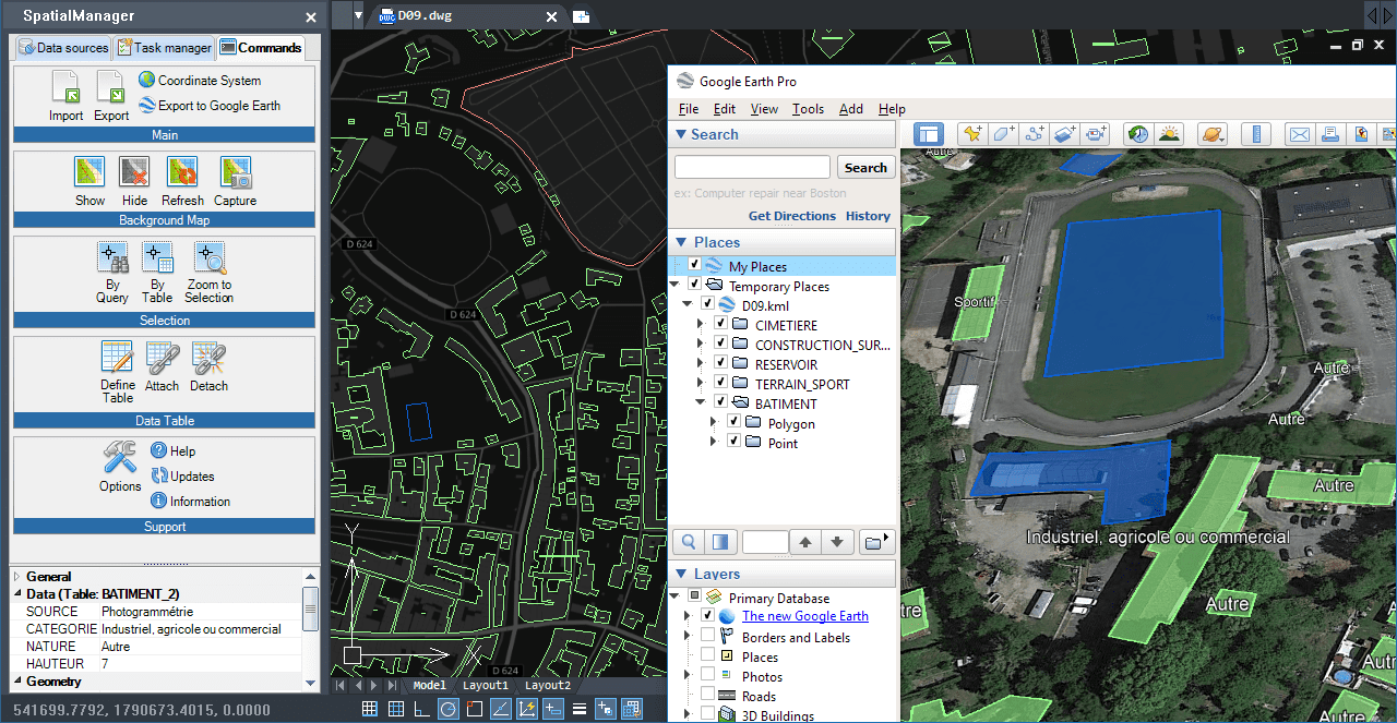
Text objects from CAD converted to Labels in Google Earth
The ‘Export to Google Earth’ (publish) tool in ‘Spatial Manager’ assumes the following automations:
- The process considers the current Layers organization and the properties of the Layers and objects
- The elements in the KML/KMZ file will assume the colors, line weights, etc. of the objects in the drawing
- A subdivision based on the type(s) of the objects in the Layers will also be created for each Layer, allowing you a high level of visibility control in Google Earth
- The values for the NAME and DESCRIPTION of the elements in the KML/KMZ file will be automatically taken from the data fields “Name” and “Description” if those exist
- The Text objects will display their content as a Label in Google Earth (automatic Field “TxtString”)
How it works?
The processes performed when Publishing to Google Earth make use internally of two application components (see the image below):
- The Export engine, whose parameter set includes the options to export several sets of Text data such as the Contents, which will go to a new data field named “TxtString”
- The KML/KMZ Data Provider, which allows you to select a data field to set the NAME of the exported objects. In the Publishing processes the field “TxtString” is automatically selected
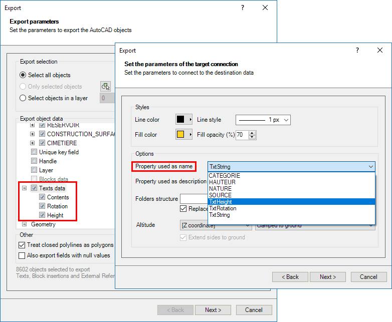
Application Export parameters set, and KML data provider parameters set
Please, go to the technical Wikis if you want to learn more about Publishing to Google Earth from CAD drawings:
· Spatial Manager for AutoCAD
· Spatial Manager for BricsCAD
· Spatial Manager for ZWCAD


