The new ‘Spatial Manager’ version 5.2 has been recently released. In addition to many other interesting new features, this release is ‘AutoCAD 2020’ compatible. Download it and enjoy from today the enhancements and new functions included in ‘AutoCAD 2020’ and ‘Spatial Manager for AutoCAD 5.2’
Import/export spatial or GIS data into/from AutoCAD (2008 to 2020) (*), and experience the advanced tools to manage spatial data, such as dynamic background maps, quick drawing publishing in Google Earth, data structures and grids, queries, layer thematics, automatic labeling, etc.
(*) And other related Autodesk products
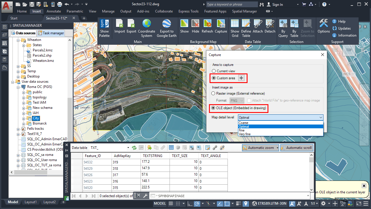
New Capture Custom Area and OLE in AutoCAD 2020
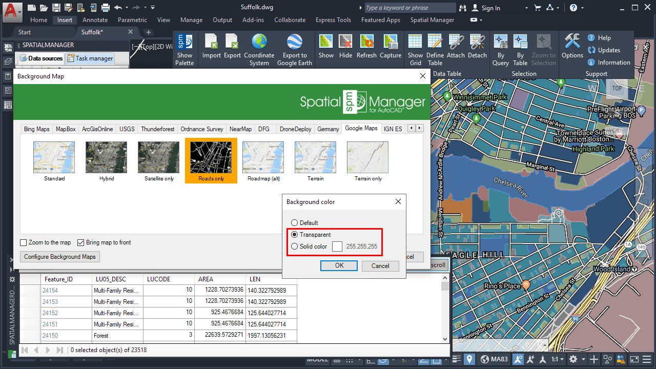
Background color/transparent options for Background Maps
New features and improvements:
- A new button allows you display the table attached to the selected object(s)
- “Forward” row navigation button is now also active even if only one object is selected
- Now you can define a capture window, not just the full screen as in previous versions
-
Image captures can now also be inserted into the drawing as OLE objects
- Related video: See previous paragraph
- You can select a background color or transparent background for WMS maps
- New NearMap API has been updated, and NearMap oblique maps have been added
- New option to select the coordinate system for XYZ/TMS maps
- Support for XYZ/TMS maps whose origin is defined bottom-left (OSGeo Specification)
- Now, in an empty unreferenced drawing, the map coordinate system is applied
- Import in one-click all schemes from a user data source (UDS) or all tables from a file
- “Back” button added at the end of the export processes allows replay them
- GML data provider now has write capability so it allows you to export to this file format
- The EPSG tables (CRSs and other objects) have been updated to version 9.6
- More than 1300 Esri coordinate systems have been added to the application database


